Difference between revisions of "2014-12-10 49 8"
imported>DODO (→Plans) |
imported>FippeBot m (Location) |
||
| (5 intermediate revisions by one other user not shown) | |||
| Line 32: | Line 32: | ||
== Expedition == | == Expedition == | ||
<!-- how it all turned out. your narrative goes here. --> | <!-- how it all turned out. your narrative goes here. --> | ||
| + | Nearly exactly as planned. I left work at 4:30 (or some minutes later) and arrived in Leimen at 16:50. From there I had to walk 1 KM and to gain 100m height in that (most of them by climbing 100 steps). When I had done the steps I turned around and enjoyed the marvelous view over Leimen and the rhine plane. Some 500 m later I reached the chosen vineyard and took the 10th lane, as google had told me that the hash would be there. Hardly any dancing brought me there. Unfortunately it was already to dark to take any meaningful pictures. So I just walked back and drove home again. | ||
== Tracklog == | == Tracklog == | ||
<!-- if your GPS device keeps a log, you may post a link here --> | <!-- if your GPS device keeps a log, you may post a link here --> | ||
| + | [https://www.komoot.de/tour/4100759 44 KM by car (instead of 25) and 2 KM by foot] | ||
== Photos == | == Photos == | ||
| Line 41: | Line 43: | ||
--> | --> | ||
<gallery perrow="5"> | <gallery perrow="5"> | ||
| + | Image:2014-12-10_49_8-1.jpg | Little car in Leimen | ||
| + | Image:2014-12-10_49_8-2.jpg | Leimen from above | ||
| + | Image:2014-12-10_49_8-3.jpg | proof | ||
| + | Image:2014-12-10_49_8-4.jpg | I hate my mobile, and it hates me. So it only makes ugly pictures of me | ||
</gallery> | </gallery> | ||
| Line 48: | Line 54: | ||
| − | + | {{land geohash | |
| − | |||
| − | |||
| − | + | | latitude = 49 | |
| + | | longitude = 8 | ||
| + | | date = 2014-12-10 | ||
| + | | name = DODO | ||
| + | }} | ||
| − | + | {{consecutive geohash | |
| − | + | | count = 3 | |
| − | + | | latitude = 49 | |
| − | + | | longitude = 8 | |
| + | | date = 2014-12-08 | ||
| + | | name = DODO | ||
| + | }} | ||
| + | |||
| + | {{Last man standing | ||
| + | | latitude = 49 | ||
| + | | longitude = 8 | ||
| + | | date = 2014-12-10 | ||
| + | | gender = man | ||
| + | | name = DODO | ||
| + | }} | ||
| − | |||
[[Category:Expeditions]] | [[Category:Expeditions]] | ||
| − | |||
[[Category:Expeditions with photos]] | [[Category:Expeditions with photos]] | ||
| − | |||
| − | |||
| − | |||
| − | |||
| − | |||
[[Category:Coordinates reached]] | [[Category:Coordinates reached]] | ||
| − | + | {{location|DE|BW|HD}} | |
| − | |||
| − | |||
| − | |||
| − | |||
| − | |||
| − | |||
| − | |||
| − | |||
| − | |||
| − | |||
| − | |||
| − | |||
| − | |||
| − | |||
| − | |||
| − | |||
| − | |||
Latest revision as of 02:09, 15 August 2019
| Wed 10 Dec 2014 in 49,8: 49.3538923, 8.6972084 geohashing.info google osm bing/os kml crox |
Location
In a vineyard above Leimen.
Participants
Plans
Looks like I have a run. After the hash was just 7 KM away from home yesterday, todays hash can be reached on my way home from the office with a less than 20 KM detour. And as it complies with my fuel policy, I'll try to go there after work. I hope to arrive around 5 pm, but I have no Glühwein with me, and so I'm afraid that no one else will appear.
Expedition
Nearly exactly as planned. I left work at 4:30 (or some minutes later) and arrived in Leimen at 16:50. From there I had to walk 1 KM and to gain 100m height in that (most of them by climbing 100 steps). When I had done the steps I turned around and enjoyed the marvelous view over Leimen and the rhine plane. Some 500 m later I reached the chosen vineyard and took the 10th lane, as google had told me that the hash would be there. Hardly any dancing brought me there. Unfortunately it was already to dark to take any meaningful pictures. So I just walked back and drove home again.
Tracklog
44 KM by car (instead of 25) and 2 KM by foot
Photos
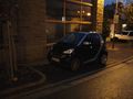
Little car in Leimen
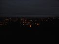
Leimen from above

proof

I hate my mobile, and it hates me. So it only makes ugly pictures of me


Achievements
DODO earned the Land geohash achievement
|
DODO earned the Consecutive geohash achievement
|
DODO earned the Last man standing achievement
|