Difference between revisions of "2014-12-26 40 -74"
imported>Jevanyn ([live] The "small business" near the geohash turned out to be the Wayne Hills Diner. I think this is Passaic County, which is the only northern county I haven't hashed in yet. Woot!) |
imported>Jevanyn |
||
| Line 18: | Line 18: | ||
__NOTOC__ | __NOTOC__ | ||
== Location == | == Location == | ||
| − | + | In front of a small business on Hamburg Turnpike, in Wayne or Pequannock | |
== Participants == | == Participants == | ||
| Line 25: | Line 25: | ||
== Plans == | == Plans == | ||
| − | + | Visiting family in Fair Lawn, taking the long way home toward the geohash, playing some Ingress along the way. | |
== Expedition == | == Expedition == | ||
| − | |||
| + | It is a modern phenomenon, to trust your life and wellbeing to the availability and accuracy of a GPS and turn-by-turn directions. All the more so when you intend to deviate from those directions constantly, as when travelling several blocks from the original route to reach Ingress portals along side streets or main roads as you cross them. | ||
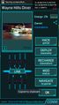
| − | + | The "small business" near the geohash turned out to be the Wayne Hills Diner. We arrived at 11PM-ish, with both kids asleep in the car, so we didn't sample the local fare. | |
| − | + | Also, Wayne is in Passaic County, which is the only northern county I hadn't hashed in yet. Woot! -- [[User:Jevanyn|Jevanyn]] ([[User talk:Jevanyn|talk]]) [http://www.openstreetmap.org/?lat=40.96380236&lon=-74.25406170&zoom=16&layers=B000FTF @40.9638,-74.2541] 22:07, 26 December 2014 (EST) | |
| − | |||
| − | |||
== Photos == | == Photos == | ||
| − | |||
| − | |||
| − | |||
<gallery perrow="5"> | <gallery perrow="5"> | ||
| Line 48: | Line 43: | ||
</gallery> | </gallery> | ||
| + | <!-- | ||
== Achievements == | == Achievements == | ||
{{#vardefine:ribbonwidth|800px}} | {{#vardefine:ribbonwidth|800px}} | ||
| − | + | Add any achievement ribbons you earned below, or remove this section --> | |
| − | |||
| − | |||
| − | |||
| − | |||
| − | |||
| − | |||
| − | |||
| − | |||
| − | |||
| − | |||
| − | |||
| − | |||
[[Category:Expeditions]] | [[Category:Expeditions]] | ||
| − | |||
[[Category:Expeditions with photos]] | [[Category:Expeditions with photos]] | ||
| − | |||
| − | |||
| − | |||
| − | |||
| − | |||
[[Category:Coordinates reached]] | [[Category:Coordinates reached]] | ||
| − | + | [[Category:Jevanyn/brought Gwynnath]] | |
| − | + | [[Category:Jevanyn/brought Evan]] | |
| − | [[Category: | + | [[Category:Jevanyn/brought Grace]] |
| − | |||
| − | |||
| − | [[Category: | ||
| − | |||
| − | |||
| − | [[Category: | ||
| − | |||
| − | |||
| − | |||
| − | |||
| − | |||
| − | |||
| − | |||
| − | |||
Revision as of 20:55, 29 December 2014
| Fri 26 Dec 2014 in 40,-74: 40.9637539, -74.2537261 geohashing.info google osm bing/os kml crox |
Location
In front of a small business on Hamburg Turnpike, in Wayne or Pequannock
Participants
Plans
Visiting family in Fair Lawn, taking the long way home toward the geohash, playing some Ingress along the way.
Expedition
It is a modern phenomenon, to trust your life and wellbeing to the availability and accuracy of a GPS and turn-by-turn directions. All the more so when you intend to deviate from those directions constantly, as when travelling several blocks from the original route to reach Ingress portals along side streets or main roads as you cross them.
The "small business" near the geohash turned out to be the Wayne Hills Diner. We arrived at 11PM-ish, with both kids asleep in the car, so we didn't sample the local fare.
Also, Wayne is in Passaic County, which is the only northern county I hadn't hashed in yet. Woot! -- Jevanyn (talk) @40.9638,-74.2541 22:07, 26 December 2014 (EST)
Photos
Gwynnath was here, too @40.9638,-74.2537

Silly grin, check @40.9638,-74.2537

