Difference between revisions of "2015-04-12 48 15"
imported>Micsnare (→Location) |
imported>FippeBot m (Location) |
||
| (14 intermediate revisions by 4 users not shown) | |||
| Line 1: | Line 1: | ||
| − | |||
| − | |||
| − | |||
| − | |||
| − | |||
| − | |||
| − | |||
| − | |||
| − | |||
| − | |||
{{meetup graticule | {{meetup graticule | ||
| lat=48 | | lat=48 | ||
| Line 14: | Line 4: | ||
| date=2015-04-12 | | date=2015-04-12 | ||
}} | }} | ||
| − | |||
__NOTOC__ | __NOTOC__ | ||
== Location == | == Location == | ||
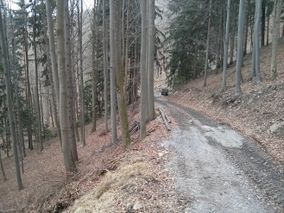
| − | The hash was located in the midst of a forest (uphill) somewhere | + | [[Image:IMG_20150412_153049.jpg| thumb | left | The usual robin-hood hash.]] |
| + | |||
| + | The hash was located in the midst of a forest (uphill) somewhere near Hainfeld/Ramsau in Lower Austria. | ||
== Participants == | == Participants == | ||
| − | |||
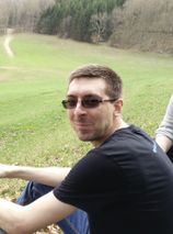
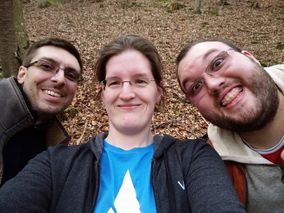
* [[User:Crankl|Crankl]] | * [[User:Crankl|Crankl]] | ||
* [[User:B2c|B2c]] | * [[User:B2c|B2c]] | ||
* [[User:Micsnare|Micsnare]] | * [[User:Micsnare|Micsnare]] | ||
| + | |||
== Plans == | == Plans == | ||
| − | + | It was a late saturday night when Crankl sent out an IM to B2c and me about possible plans for the sunday hash. Both the Vienna hash as well as the St. Pölten graticule hash, which looked like it would be one of those up in the woods hashes again. We briefly also discussed about doing the Brno graticule, because this was one of the graticules that each of us had yet to hash. | |
| + | However we went with the 48-15 hash as it looked fairly easy and since we also wanted to grab the Vienna hash we went with the time-saver alternative ;) | ||
| + | We decided to meet at 2PM (CEST) at the hashcave, and the last one to arrive there would have to write the hashreports. Little did I know that B2C was already waiting there, and Crankl was way ahead of me..... | ||
| + | Since it was me who came up with this stupid idea, the boys pleasurably held this against me for the rest of the afternoon :p | ||
| + | |||
== Expedition == | == Expedition == | ||
| − | + | The route to the hashpoint was easy-going accompanied by the usual banter in the car about music, work-related stuff and the latest politics. We arrived on time, it was cloudy but all-in-all the perfect hash weather, we quickly changed into our hashboots and off we were. To tell the truth I didn't really look it up and left it up to the boys, so I didn't quite know what to expect. I expected the hash to lie in the middle of a meadow or field, but certainly not up a hill in a forest again. | |
| + | It was B2c who was quickly up the hill guiding us to the hash. Since the GPS signal usually isn't so great in the middle of nowhere deep down in a forest it took us a while to find the right spot. But after the usual dance, we reached it on spot. | ||
| + | Crankl also surprised us as he had brought the perfect incredients for a picknick, which consisted of a plaited pun, crackers and bottled water. Exactly what hasher need after successfully climbing a hill and reaching their hashpoint ;) Thank you, Crankl!! | ||
| + | It was Micsnare who came up with the brilliant idea to play some music on her phone....Picknick and music, could this sunday be any better? | ||
| + | == Geohash Droid Post == | ||
*Yay, we 've reached it ;) -- [[User:Micsnare|Micsnare]] ([[User talk:Micsnare|talk]]) [http://www.openstreetmap.org/?lat=48.01940043&lon=15.77097099&zoom=16&layers=B000FTF @48.0194,15.7710] 09:46, 12 April 2015 (EDT) | *Yay, we 've reached it ;) -- [[User:Micsnare|Micsnare]] ([[User talk:Micsnare|talk]]) [http://www.openstreetmap.org/?lat=48.01940043&lon=15.77097099&zoom=16&layers=B000FTF @48.0194,15.7710] 09:46, 12 April 2015 (EDT) | ||
| + | |||
| + | |||
== Tracklog == | == Tracklog == | ||
| − | + | The tracklog is available at the [[2015-04-12_48_16]] page. | |
== Photos == | == Photos == | ||
| − | < | + | <gallery caption="Photo Gallery" widths="320px" heights="213px" perrow="3"> |
| − | Image: | + | Image:IMG 20150412 151621 new.jpg | Crankl pointing to the right direction. |
| − | -- | + | Image:IMG 20150412 152723.jpg | The hash was somewhere up there. |
| − | + | Image:IMG 20150412 152728.jpg | Crankl and Micsnare making their way up. | |
| + | Image:IMG 20150412 153049.jpg | Isn't it beautiful up there? | ||
| + | Image:IMG 20150412 154003.jpg | It's right down here. | ||
| + | Image:IMG 20150412 154013.jpg | Almost there. | ||
| + | Image:IMG 20150412 154026.jpg | Here. Finally. Our Hashpoint. | ||
| + | Image:IMG 20150412 155817.jpg | Picknick supplied by Crankl. | ||
| + | Image:IMG 20150412 160214.jpg | The view from the hashpoint, where we picknicked. | ||
| + | Image:13.04.15 - 9.jpg | B2c enjoying the picknick. | ||
| + | Image:13.04.15 - 10.jpg | Crankl having a laugh. | ||
| + | Image:13.04.15 - 12.jpg | Stupid Grin. (tm) | ||
| + | Image:Screenshot 2015-04-12-15-45-27.png | Proof. | ||
| + | Image:Screenshot 2015-04-12-18-26-51.png | More proof. | ||
</gallery> | </gallery> | ||
== Achievements == | == Achievements == | ||
{{#vardefine:ribbonwidth|800px}} | {{#vardefine:ribbonwidth|800px}} | ||
| − | + | {{Picnic_geohash | |
| − | + | | latitude = 48 | |
| − | + | | longitude = 15 | |
| − | + | | date = 2015-04-12 | |
| + | | name = [[User:B2c|B2c]] | ||
| + | | image = IMG_20150412_155817.jpg | ||
| + | | food = crackers, plaited bun and bottled water - a late easter picknick. | ||
| + | }} | ||
| + | {{Picnic_geohash | ||
| + | | latitude = 48 | ||
| + | | longitude = 15 | ||
| + | | date = 2015-04-12 | ||
| + | | name = [[User:Crankl|Crankl]] | ||
| + | | image = IMG_20150412_155817.jpg | ||
| + | | food = crackers, plaited bun and bottled water - a late easter picknick. | ||
| + | }} | ||
| + | {{Picnic_geohash | ||
| + | | latitude = 48 | ||
| + | | longitude = 15 | ||
| + | | date = 2015-04-12 | ||
| + | | name = [[User:Micsnare|Micsnare]] | ||
| + | | image = IMG_20150412_155817.jpg | ||
| + | | food = crackers, plaited bun and bottled water - a late easter picknick. | ||
| + | }} | ||
[[Category:Expeditions]] | [[Category:Expeditions]] | ||
[[Category:Coordinates reached]] | [[Category:Coordinates reached]] | ||
| − | |||
| − | |||
| − | |||
| − | |||
| − | |||
| − | |||
| − | |||
| − | |||
| − | |||
| − | |||
| − | |||
| − | |||
| − | |||
| − | |||
| − | |||
| − | |||
[[Category:Expeditions with photos]] | [[Category:Expeditions with photos]] | ||
| − | + | {{location|AT|NÖ|LF}} | |
| − | |||
| − | |||
| − | |||
| − | |||
| − | |||
| − | |||
| − | |||
| − | |||
| − | |||
| − | |||
| − | |||
| − | |||
| − | |||
| − | |||
| − | |||
| − | |||
| − | |||
| − | |||
| − | |||
| − | |||
| − | |||
| − | |||
| − | |||
Latest revision as of 03:18, 15 August 2019
| Sun 12 Apr 2015 in 48,15: 48.0194212, 15.7709179 geohashing.info google osm bing/os kml crox |
Location

The hash was located in the midst of a forest (uphill) somewhere near Hainfeld/Ramsau in Lower Austria.
Participants
Plans
It was a late saturday night when Crankl sent out an IM to B2c and me about possible plans for the sunday hash. Both the Vienna hash as well as the St. Pölten graticule hash, which looked like it would be one of those up in the woods hashes again. We briefly also discussed about doing the Brno graticule, because this was one of the graticules that each of us had yet to hash. However we went with the 48-15 hash as it looked fairly easy and since we also wanted to grab the Vienna hash we went with the time-saver alternative ;) We decided to meet at 2PM (CEST) at the hashcave, and the last one to arrive there would have to write the hashreports. Little did I know that B2C was already waiting there, and Crankl was way ahead of me..... Since it was me who came up with this stupid idea, the boys pleasurably held this against me for the rest of the afternoon :p
Expedition
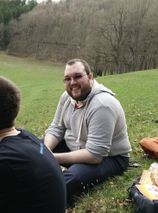
The route to the hashpoint was easy-going accompanied by the usual banter in the car about music, work-related stuff and the latest politics. We arrived on time, it was cloudy but all-in-all the perfect hash weather, we quickly changed into our hashboots and off we were. To tell the truth I didn't really look it up and left it up to the boys, so I didn't quite know what to expect. I expected the hash to lie in the middle of a meadow or field, but certainly not up a hill in a forest again. It was B2c who was quickly up the hill guiding us to the hash. Since the GPS signal usually isn't so great in the middle of nowhere deep down in a forest it took us a while to find the right spot. But after the usual dance, we reached it on spot. Crankl also surprised us as he had brought the perfect incredients for a picknick, which consisted of a plaited pun, crackers and bottled water. Exactly what hasher need after successfully climbing a hill and reaching their hashpoint ;) Thank you, Crankl!! It was Micsnare who came up with the brilliant idea to play some music on her phone....Picknick and music, could this sunday be any better?
Geohash Droid Post
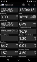
- Yay, we 've reached it ;) -- Micsnare (talk) @48.0194,15.7710 09:46, 12 April 2015 (EDT)
Tracklog
The tracklog is available at the 2015-04-12_48_16 page.
Photos
- Photo Gallery

Crankl pointing to the right direction.
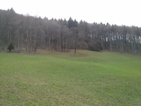
The hash was somewhere up there.
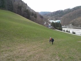
Crankl and Micsnare making their way up.
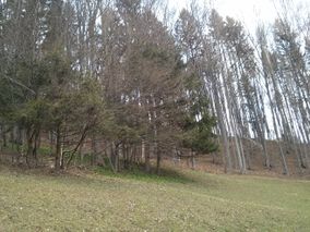
Isn't it beautiful up there?
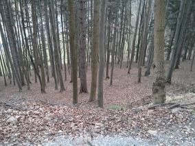
It's right down here.
Almost there.
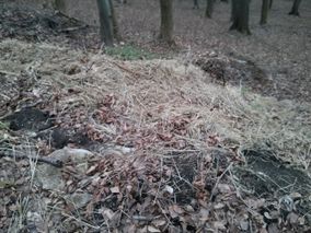
Here. Finally. Our Hashpoint.
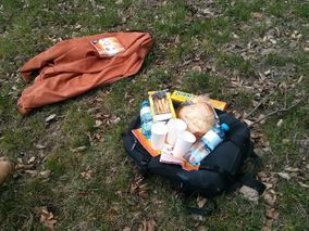
Picknick supplied by Crankl.
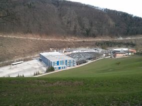
The view from the hashpoint, where we picknicked.
B2c enjoying the picknick.
Crankl having a laugh.
Stupid Grin. (tm)

Proof.
More proof.


Achievements
B2c earned the Picnic achievement
|
Crankl earned the Picnic achievement
|
Micsnare earned the Picnic achievement
|