Difference between revisions of "2015-04-26 47 -122"
From Geohashing
imported>Thomcat ([live picture] [http://www.openstreetmap.org/?lat=47.62814714&lon=-122.35185194&zoom=16&layers=B000FTF @47.6281,-122.3519]) |
imported>Thomcat ([live picture] [http://www.openstreetmap.org/?lat=47.62807181&lon=-122.35160993&zoom=16&layers=B000FTF @47.6281,-122.3516]) |
||
| Line 36: | Line 36: | ||
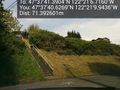
Image:2015-04-26_47_-122_thomcat_1430082535359.jpg | [http://www.openstreetmap.org/?lat=47.62814714&lon=-122.35185194&zoom=16&layers=B000FTF @47.6281,-122.3519] | Image:2015-04-26_47_-122_thomcat_1430082535359.jpg | [http://www.openstreetmap.org/?lat=47.62814714&lon=-122.35185194&zoom=16&layers=B000FTF @47.6281,-122.3519] | ||
| + | |||
| + | Image:2015-04-26_47_-122_thomcat_1430082687849.jpg | [http://www.openstreetmap.org/?lat=47.62807181&lon=-122.35160993&zoom=16&layers=B000FTF @47.6281,-122.3516] | ||
</gallery> | </gallery> | ||
Revision as of 21:11, 26 April 2015
| Sun 26 Apr 2015 in Seattle: 47.6281640, -122.3518655 geohashing.info google osm bing/os kml crox |
Location
Queen Anne Hill in Seattle, with a view of the Space Needle.
Participants
Plans
Visit approximately 2pm, then head to Magnolia for two baseball games (weather permitting)
Expedition
Tracklog
Photos
View from below @47.6280,-122.3528


Achievements