Difference between revisions of "2015-06-28 50 19"
imported>Malgond (→Plans) |
imported>Malgond (→Plans) |
||
| Line 18: | Line 18: | ||
[[User:Malgond|Malgond]] plans to go there by car, on the way home from a family visit. | [[User:Malgond|Malgond]] plans to go there by car, on the way home from a family visit. | ||
| − | + | <gallery perrow="2" widths="400px" heights="300px" mode="nolines"> | |
| − | + | Image:2015-06-28_50_19-location1.png | Location of the geoash | |
| − | + | Image:2015-06-28_50_19-location2.png | Map of the geohash surroundings | |
| + | Image:2015-06-28_50_19-location3.png | Road to the geohash | ||
| + | Image:2015-06-28_50_19-location4.png | Distance to the geohash | ||
| + | </gallery> | ||
== Expedition == | == Expedition == | ||
Revision as of 13:58, 29 June 2015
| Sun 28 Jun 2015 in 50,19: 50.1041680, 19.1525844 geohashing.info google osm bing/os kml crox |
Location
On the bank of a stream in Goławiec, Poland.
Participants
Malgond and his son.
Plans
Malgond plans to go there by car, on the way home from a family visit.
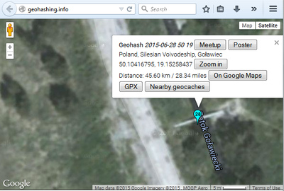
Location of the geoash
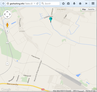
Map of the geohash surroundings
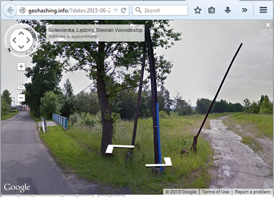
Road to the geohash
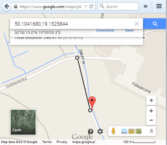
Distance to the geohash


Expedition
This Sunday we were visiting our family in a nearby city. After the celebration, I have made a small detour on our way home to visit the geohash. I have left our usual route by turning into a road leading to the village of Górki and then towards Goławiec. Driving along the road connecting Górki and Goławiec, I have reached the bridge on Potok Goławiecki. Just before the bridge there was a small country track to the right, going along the stream. It was made of concrete slabs most of which were tilted, pitted, broken and covered with mud and sand. I was driving very slowly and cautiously, weaving a lot to avoid the largest pits. Soon, I have arrived at a place where the next slab was broken in half with the reinforcing steel rods sticking out. I concluded that crossing it is too risky for our car, so I got out with my younger son and we have walked the remaining forty meters or so.
What looked like footbridge on Google Maps turned out to be a gas pipeline crossing the stream. The stream's bank was heavily overgrown therefore I have not risked getting any closer than the brink of the road, but if Google Maps aerial view is accurate, we were only 5 meters from the exact point. I have made some photos, had my son make a photo of myself and we walked back to our car. Then I had to back out the car carefully all the way back to the asphalt road, then we continued home.
Photos
I'll upload the photos later.
Achievements