Difference between revisions of "2015-07-23 47 -122"
From Geohashing
imported>Thomcat ([live picture] [http://www.openstreetmap.org/?lat=47.67731750&lon=-122.25819465&zoom=16&layers=B000FTF @47.6773,-122.2582]) |
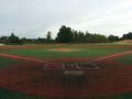
imported>Thomcat ([live picture] Normally a pond, lots of foul balls [http://www.openstreetmap.org/?lat=47.67715005&lon=-122.25877054&zoom=16&layers=B000FTF @47.6772,-122.2588]) |
||
| Line 54: | Line 54: | ||
Image:2015-07-23_47_-122_thomcat_1437664621030.jpg | [http://www.openstreetmap.org/?lat=47.67731750&lon=-122.25819465&zoom=16&layers=B000FTF @47.6773,-122.2582] | Image:2015-07-23_47_-122_thomcat_1437664621030.jpg | [http://www.openstreetmap.org/?lat=47.67731750&lon=-122.25819465&zoom=16&layers=B000FTF @47.6773,-122.2582] | ||
| + | |||
| + | Image:2015-07-23_47_-122_thomcat_1437664723855.jpg | Normally a pond, lots of foul balls [http://www.openstreetmap.org/?lat=47.67715005&lon=-122.25877054&zoom=16&layers=B000FTF @47.6772,-122.2588] | ||
</gallery> | </gallery> | ||
Revision as of 15:20, 23 July 2015
| Thu 23 Jul 2015 in Seattle: 47.6756476, -122.2690233 geohashing.info google osm bing/os kml crox |
Location
On 65th, a few blocks up from Sandpoint and the Burke-Gilman Trail.
Participants
Plans
Initial scouting before work. Will also snap photos of the trail and the park.
Expedition
I was working (as an umpire) just a few blocks from this geohashpoint yesterday, but I don't routinely wander onto front lawns and snap pictures. Well, I already have a perfect Déjà Vu geohash.
Tracklog
Photos

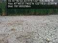
Wishing meter @47.6757,-122.2689
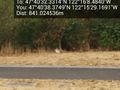
Where I was working last night @47.6773,-122.2583
Bunny @47.6773,-122.2581
Normally a pond, lots of foul balls @47.6772,-122.2588


Achievements