Difference between revisions of "2015-08-04 49 9"
imported>Tads (new expedition) |
imported>FippeBot m (Location) |
||
| (2 intermediate revisions by 2 users not shown) | |||
| Line 1: | Line 1: | ||
| − | |||
| − | |||
| − | |||
| − | |||
| − | |||
| − | |||
| − | |||
| − | |||
| − | |||
| − | |||
{{meetup graticule | {{meetup graticule | ||
| lat=49 | | lat=49 | ||
| Line 19: | Line 9: | ||
== Location == | == Location == | ||
| − | + | in a forest close to Babenhausen (Hessen) | |
== Participants == | == Participants == | ||
| − | + | [[User:Tads|Tads]] ([[User talk:Tads|talk]]) | |
| − | |||
| − | == | + | == Expedition == |
| − | + | For this expedition I first took the train from Darmstadt to Otzberg-Lengfeld. From there I cycled (via Habitzheim, Groß-Umstadt-Richen, Klein-Umstadt and Langstadt) to the hashpoint which was approx. a 21km ride. The hash was located directly next to a forest pathway, so there was no need to wander through the thicket. | |
| − | + | Luckily, I arrived at the train station of Babenhausen (after another 5km) before it started to rain. | |
| − | + | I had missed the previous train back to Darmstadt just by 10 minutes, so I had to wait 50 minutes for the next to come. | |
| + | Back in Darmstadt, the rain had stopped already, so I could ride back without getting wet. | ||
| − | + | This has been my first expedition in the 49,9 graticule. | |
| − | |||
== Photos == | == Photos == | ||
| − | |||
| − | |||
| − | |||
<gallery perrow="5"> | <gallery perrow="5"> | ||
| + | Image:tads_2015-08-04_49_9_ontheway_sunflowers.jpg | On the way to the hash: Sunflowers | ||
| + | Image:tads_2015-08-04_49_9_proof.png | GPS proof | ||
| + | Image:tads_2015-08-04_49_9_marker.jpg | Marker | ||
| + | Image:tads_2015-08-04_49_9_surrounding1.jpg | In the wood | ||
| + | Image:tads_2015-08-04_49_9_surrounding2.jpg | In the wood | ||
</gallery> | </gallery> | ||
== Achievements == | == Achievements == | ||
{{#vardefine:ribbonwidth|800px}} | {{#vardefine:ribbonwidth|800px}} | ||
| − | + | {{Minesweeper geohash | |
| + | | graticule = Mannheim, Germany | ||
| + | | ranknumber = 1 | ||
| + | | e = true | ||
| + | | name = tads | ||
| + | }} | ||
| − | |||
| − | |||
| − | |||
| − | |||
| − | |||
| − | |||
| − | |||
| − | |||
| − | |||
| − | |||
| − | |||
| − | |||
[[Category:Expeditions]] | [[Category:Expeditions]] | ||
| − | |||
[[Category:Expeditions with photos]] | [[Category:Expeditions with photos]] | ||
| − | |||
| − | |||
| − | |||
| − | |||
| − | |||
[[Category:Coordinates reached]] | [[Category:Coordinates reached]] | ||
| − | + | {{location|DE|HE|DA}} | |
| − | |||
| − | |||
| − | |||
| − | |||
| − | |||
| − | |||
| − | |||
| − | |||
| − | |||
| − | |||
| − | |||
| − | |||
| − | |||
| − | |||
| − | |||
| − | |||
| − | |||
Latest revision as of 04:40, 15 August 2019
| Tue 4 Aug 2015 in 49,9: 49.9503150, 9.0122907 geohashing.info google osm bing/os kml crox |
Location
in a forest close to Babenhausen (Hessen)
Participants
Expedition
For this expedition I first took the train from Darmstadt to Otzberg-Lengfeld. From there I cycled (via Habitzheim, Groß-Umstadt-Richen, Klein-Umstadt and Langstadt) to the hashpoint which was approx. a 21km ride. The hash was located directly next to a forest pathway, so there was no need to wander through the thicket.
Luckily, I arrived at the train station of Babenhausen (after another 5km) before it started to rain. I had missed the previous train back to Darmstadt just by 10 minutes, so I had to wait 50 minutes for the next to come. Back in Darmstadt, the rain had stopped already, so I could ride back without getting wet.
This has been my first expedition in the 49,9 graticule.
Photos
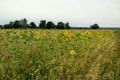
On the way to the hash: Sunflowers
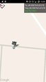
GPS proof
Marker
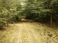
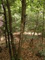
In the wood
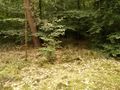
In the wood


Achievements
tads achieved level 1 of the Minesweeper Geohash achievement
|