Difference between revisions of "2015-08-08 39 -77"
From Geohashing
imported>OfficeLinebacker ([live picture] [http://www.openstreetmap.org/?lat=39.17680000&lon=-77.23400000&zoom=16&layers=B000FTF @39.1768,-77.2340]) |
imported>FippeBot m (Location) |
||
| (4 intermediate revisions by 2 users not shown) | |||
| Line 31: | Line 31: | ||
<!-- how it all turned out. your narrative goes here. --> | <!-- how it all turned out. your narrative goes here. --> | ||
| + | |||
| + | *Made it! It's at Plum Gar Community Center in Gaithersburg, MD. -- [[User:OfficeLinebacker|OfficeLinebacker]] ([[User talk:OfficeLinebacker|talk]]) 20:07, 8 August 2015 (EDT) | ||
== Tracklog == | == Tracklog == | ||
<!-- if your GPS device keeps a log, you may post a link here --> | <!-- if your GPS device keeps a log, you may post a link here --> | ||
| Line 45: | Line 47: | ||
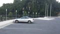
Image:2015-08-08_39_-77_OfficeLinebacker_1439078605735.jpg | [http://www.openstreetmap.org/?lat=39.17680000&lon=-77.23400000&zoom=16&layers=B000FTF @39.1768,-77.2340] | Image:2015-08-08_39_-77_OfficeLinebacker_1439078605735.jpg | [http://www.openstreetmap.org/?lat=39.17680000&lon=-77.23400000&zoom=16&layers=B000FTF @39.1768,-77.2340] | ||
| + | |||
| + | Image:2015-08-08_39_-77_OfficeLinebacker_1439078580833.jpg | [http://www.openstreetmap.org/?lat=39.17680000&lon=-77.23400000&zoom=16&layers=B000FTF @39.1768,-77.2340] | ||
</gallery> | </gallery> | ||
== Achievements == | == Achievements == | ||
{{#vardefine:ribbonwidth|800px}} | {{#vardefine:ribbonwidth|800px}} | ||
| − | |||
| − | |||
| − | |||
| − | |||
| − | |||
| − | |||
| − | |||
| − | |||
| − | |||
| − | |||
| − | |||
| − | |||
| − | |||
[[Category:Expeditions]] | [[Category:Expeditions]] | ||
| − | |||
[[Category:Expeditions with photos]] | [[Category:Expeditions with photos]] | ||
| − | |||
| − | |||
| − | |||
| − | |||
| − | |||
[[Category:Coordinates reached]] | [[Category:Coordinates reached]] | ||
| − | + | {{location|US|MD|MO}} | |
| − | |||
| − | |||
| − | |||
| − | |||
| − | |||
| − | |||
| − | |||
| − | |||
| − | |||
| − | |||
| − | |||
| − | |||
| − | |||
| − | |||
| − | |||
| − | |||
| − | |||
Latest revision as of 04:43, 15 August 2019
| Sat 8 Aug 2015 in 39,-77: 39.1767161, -77.2339145 geohashing.info google osm bing/os kml crox |
Location
Participants
Plans
Expedition
- Made it! It's at Plum Gar Community Center in Gaithersburg, MD. -- OfficeLinebacker (talk) 20:07, 8 August 2015 (EDT)
Tracklog
Photos

It's Johnny on the Spot! @39.1769,-77.2340
My car one spot over from the spot. Is this a drive through achievement if I pull into the spot? @39.1768,-77.2340


