Difference between revisions of "2015-09-03 49 8"
From Geohashing
imported>Tads (→Achievements) |
imported>Tads (→Tracklog) |
||
| Line 31: | Line 31: | ||
== Tracklog == | == Tracklog == | ||
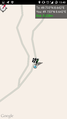
| − | + | [https://www.google.com/maps/d/edit?mid=z4gnKDo1tzTs.kbFWFNZOyPmM&usp=sharing GPS log & map] | |
== Photos == | == Photos == | ||
Revision as of 13:46, 4 September 2015
| Thu 3 Sep 2015 in 49,8: 49.7331961, 8.6424850 geohashing.info google osm bing/os kml crox |
Location
Almost on top of the Melibokus hill, in a wood close to Alsbach-Hähnlein.
Participants
Plans
Tads considered going on his bike, the idea was to also visit Schloss Alsbach, Melibokus and Schloss Auerbach which are close by.
Expedition
Tracklog
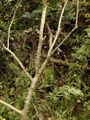
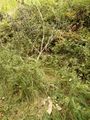
Photos
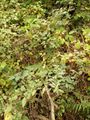
View to the spot, blackberries grow there
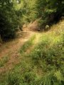
View to the north
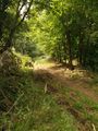
View to the south
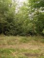
View to the west
GPS proof
Chalk mark
Stone arrow to the hash location


