Difference between revisions of "2015-09-11 54 17"
From Geohashing
imported>Klucken m (+photo) |
imported>Klucken m (+Achievements) |
||
| Line 25: | Line 25: | ||
</gallery> | </gallery> | ||
| + | == Achievements == | ||
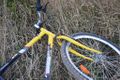
| + | {{bicycle geohash | ||
| + | | latitude = 54 | ||
| + | | longitude = 17 | ||
| + | | date = 2015-09-11 | ||
| + | | name = Klucken | ||
| + | | distance = 37.5km | ||
| + | | bothways = true | ||
| + | | image = 2015-09-11 54 17 bicycle.jpg | ||
| + | }} | ||
[[Category:Expeditions]] | [[Category:Expeditions]] | ||
[[Category:Expeditions with photos]] | [[Category:Expeditions with photos]] | ||
[[Category:Coordinates reached]] | [[Category:Coordinates reached]] | ||
Revision as of 19:51, 11 September 2015
| Fri 11 Sep 2015 in 54,17: 54.4925934, 17.2019514 geohashing.info google osm bing/os kml crox |
Location
A field between the villages Grąsino, Karżniczka and Zagórzyca, 2,5 km west of Karżniczka.
Participants
Expedition
Photos

proof
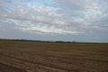
on the east
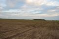
on the south
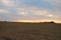
on the west
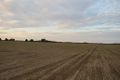
on the north

church in Zagórzyca, distance 1,8km, azimuth 142°
my tired horse


Achievements
Klucken earned the Bicycle geohash achievement
|