Difference between revisions of "2015-12-17 49 8"
imported>DODO (→Expedition) |
imported>FippeBot m (Location) |
||
| (3 intermediate revisions by one other user not shown) | |||
| Line 41: | Line 41: | ||
== Tracklog == | == Tracklog == | ||
<!-- if your GPS device keeps a log, you may post a link here --> | <!-- if your GPS device keeps a log, you may post a link here --> | ||
| + | [http://www.gpsies.com/map.do?fileId=pkwtqosqwzllwafv 1 KM walk and 11 KM by car] | ||
== Photos == | == Photos == | ||
| Line 47: | Line 48: | ||
--> | --> | ||
<gallery perrow="5"> | <gallery perrow="5"> | ||
| + | Image:2015-12-17_49_8-1.jpg|proof | ||
| + | Image:2015-12-17_49_8-2.jpg|moon | ||
| + | Image:2015-12-17_49_8-3.jpg|happy hasher | ||
</gallery> | </gallery> | ||
| Line 52: | Line 56: | ||
{{#vardefine:ribbonwidth|800px}} | {{#vardefine:ribbonwidth|800px}} | ||
<!-- Add any achievement ribbons you earned below, or remove this section --> | <!-- Add any achievement ribbons you earned below, or remove this section --> | ||
| + | {{land geohash | ||
| + | | latitude = 49 | ||
| + | | longitude = 8 | ||
| + | | date = 2015-12-17 | ||
| + | | name = DODO | ||
| + | }} | ||
| − | |||
| − | |||
| − | |||
| − | + | {{consecutive geohash | |
| − | + | | count = 2 | |
| − | + | | latitude = 49 | |
| − | -- | + | | longitude = 8 |
| − | + | | date = 2015-12-16 | |
| − | + | | name = DODO | |
| + | }} | ||
| − | |||
[[Category:Expeditions]] | [[Category:Expeditions]] | ||
| − | |||
[[Category:Expeditions with photos]] | [[Category:Expeditions with photos]] | ||
| − | |||
| − | |||
| − | |||
| − | |||
| − | |||
[[Category:Coordinates reached]] | [[Category:Coordinates reached]] | ||
| − | + | {{location|DE|RP|SP}} | |
| − | |||
| − | |||
| − | |||
| − | |||
| − | |||
| − | |||
| − | |||
| − | |||
| − | |||
| − | |||
| − | |||
| − | |||
| − | |||
| − | |||
| − | |||
| − | |||
| − | |||
Latest revision as of 06:10, 15 August 2019
| Thu 17 Dec 2015 in 49,8: 49.3441408, 8.4632205 geohashing.info google osm bing/os kml crox |
Location
On a lawn next to a lake in Speyer.
Participants
Plans
It's much to close to not going there. I want to walk there or ride on my bull in the evening.
Expedition
Well, this turned out to be much harder than expected. I was stuck in the office and came home late (around 6 pm). Here I found a note, that little lady has a singing performance this evening at 19:30, and of course I am expected to go there. So it was definitely not enough time to walk there (although I had already planned an excellent tron-route of 12 KM length).
So I decided to ride there on my bull and continue the ride to little lady school. I had brought the bull to an inspection yesterday so I had to walk 10 minutes to the garage. When I arrived there I was told that they had to change some parts and that they had ordered them but they won't arrive before Monday, so I couldn't take the bull with me. I hurried back to take my bike. One hour left should be enough time to make it o the hash and the school, but when I came home I found out that the light of the bike isn't working.
So I had no other choice than go hashing by car again. It was just a 10 minutes drive. The hardest part was to find a place to leave the car. Then followed a 500m walk along the bike lane along the street through the darkness, only disturbed by the occasionally passing cars. The hash lies 5 m next to the bike lane on a meadow. I took the pictures walked back and continued my drive for anther five minutes into town again. What I didn't know was that a firework was announced for that evening and so it took me almost a quarter of an hour to find a parking space even for the little car. So I arrived school just five minutes before the concert started.
Tracklog
Photos
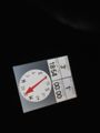
proof

moon

happy hasher


Achievements
DODO earned the Land geohash achievement
|
DODO earned the Consecutive geohash achievement
|