Difference between revisions of "2016-01-16 52 1"
From Geohashing
imported>Sourcerer m (→Planning) |
imported>Sourcerer m ([live picture] Arrival proof. [http://www.openstreetmap.org/?lat=52.52125204&lon=1.48197949&zoom=16&layers=B000FTF @52.5213,1.4820]) |
||
| Line 23: | Line 23: | ||
== Photos == | == Photos == | ||
<gallery perrow=4> | <gallery perrow=4> | ||
| + | |||
| + | Image:2016-01-16_52_1_Sourcerer_1452953388592.jpg | Arrival proof. [http://www.openstreetmap.org/?lat=52.52125204&lon=1.48197949&zoom=16&layers=B000FTF @52.5213,1.4820] | ||
</gallery> | </gallery> | ||
Revision as of 14:12, 16 January 2016
| Sat 16 Jan 2016 in Norwich, UK: 52.5212689, 1.4820224 geohashing.info google osm bing/os kml crox |
Location
A field south of Loddon, Norfolk, UK.
Participants
Plans
Expedition
Photos
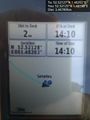
Arrival proof. @52.5213,1.4820

Achievements
Sourcerer earned the Midnight Geohash achievement
|
Expeditions and Plans
| 2016-01-16 | ||
|---|---|---|
| Mannheim, Germany | Q-Owl, Q-Owla | In the northern part of Mannheim City on the roof of a company. |
| Norwich, United Kingdom | Sourcerer | A field south of Loddon, Norfolk, UK. |
| Turku, Finland | PPP | Very close to hedgefence in the left at the address Risukarhikuja 8, 21420 ... |
Sourcerer's Expedition Links
2016-01-15 52 1 - 2016-01-16 52 1 - 2016-01-17 52 1 - KML file download of Sourcerer's expeditions for use with Google Earth.