Difference between revisions of "2016-01-25 47 -122"
imported>Thomcat ([live picture]Outside the fence [http://www.openstreetmap.org/?lat=47.33228090&lon=-122.21131140&zoom=16&layers=B000FTF @47.3323,-122.2113]) |
imported>FippeBot m (Location) |
||
| (3 intermediate revisions by one other user not shown) | |||
| Line 1: | Line 1: | ||
| − | |||
| − | |||
| − | |||
| − | |||
| − | |||
| − | |||
| − | |||
| − | |||
| − | |||
| − | |||
{{meetup graticule | {{meetup graticule | ||
| lat=47 | | lat=47 | ||
| lon=-122 | | lon=-122 | ||
| date=2016-01-25 | | date=2016-01-25 | ||
| + | | graticule_name=Seattle | ||
| + | | graticule_link=Seattle, Washington | ||
}} | }} | ||
| Line 19: | Line 11: | ||
== Location == | == Location == | ||
| − | + | Inside the fence at Auburn Golf Course | |
== Participants == | == Participants == | ||
| − | + | * [[User:Thomcat|Thomcat]] | |
| − | |||
== Plans == | == Plans == | ||
| Line 29: | Line 20: | ||
== Expedition == | == Expedition == | ||
| − | + | Headed down to Kentridge High School for a meeting at 6:30, which means fighting traffic no matter when I go. Leaving at 4:30, I hoped to make it to the area before full dark - a forlorn hope. | |
| + | Scanning the satellite map, I saw an entrance gate (for maintenance vehicles, or maybe for those golf carts) just north of the hashpoint, so I aimed for that. A missed aim, as it turned out - the gate was closed and, while not marked "no trespass", was still marked "employees only". Probably too late at night for them to hire me. | ||
| + | |||
| + | What the fence also lacked was a pedestrian pass through of any kind - if you slice that much, I guess you just lose the ball. | ||
*Closest I can get -- [[User:Thomcat|Thomcat]] ([[User talk:Thomcat|talk]]) [http://www.openstreetmap.org/?lat=47.33228040&lon=-122.21128980&zoom=16&layers=B000FTF @47.3323,-122.2113] 18:03, 25 January 2016 (PST) | *Closest I can get -- [[User:Thomcat|Thomcat]] ([[User talk:Thomcat|talk]]) [http://www.openstreetmap.org/?lat=47.33228040&lon=-122.21128980&zoom=16&layers=B000FTF @47.3323,-122.2113] 18:03, 25 January 2016 (PST) | ||
| + | |||
| + | Drove north and into the entrance, noting I was over 500 m from the hash point. While I didn't look for "please feel free to wander our golf course at night" signs, I also didn't relish a walk on damp fairways after dark. Marking this one a failed to reach, I continued to my meeting. | ||
| + | |||
== Tracklog == | == Tracklog == | ||
<!-- if your GPS device keeps a log, you may post a link here --> | <!-- if your GPS device keeps a log, you may post a link here --> | ||
| Line 43: | Line 40: | ||
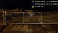
Image:2016-01-25_47_-122_thomcat_1453773888337.jpg|Outside the fence [http://www.openstreetmap.org/?lat=47.33228090&lon=-122.21131140&zoom=16&layers=B000FTF @47.3323,-122.2113] | Image:2016-01-25_47_-122_thomcat_1453773888337.jpg|Outside the fence [http://www.openstreetmap.org/?lat=47.33228090&lon=-122.21131140&zoom=16&layers=B000FTF @47.3323,-122.2113] | ||
| + | |||
| + | Image:2016-01-25_47_-122_thomcat_1453773999123.jpg|Employees only [http://www.openstreetmap.org/?lat=47.33293000&lon=-122.21095180&zoom=16&layers=B000FTF @47.3329,-122.2110] | ||
| + | |||
| + | Image:2016-01-25_47_-122_thomcat_1453774157051.jpg|Auburn GC [http://www.openstreetmap.org/?lat=47.33622340&lon=-122.20819650&zoom=16&layers=B000FTF @47.3362,-122.2082] | ||
</gallery> | </gallery> | ||
| Line 49: | Line 50: | ||
<!-- Add any achievement ribbons you earned below, or remove this section --> | <!-- Add any achievement ribbons you earned below, or remove this section --> | ||
| − | |||
| − | |||
| − | |||
| − | |||
| − | |||
| − | |||
| − | |||
| − | |||
| − | |||
| − | |||
| − | |||
| − | |||
[[Category:Expeditions]] | [[Category:Expeditions]] | ||
| − | |||
[[Category:Expeditions with photos]] | [[Category:Expeditions with photos]] | ||
| − | |||
| − | |||
| − | |||
| − | |||
| − | |||
| − | |||
| − | |||
| − | |||
| − | |||
[[Category:Coordinates not reached]] | [[Category:Coordinates not reached]] | ||
| − | |||
| − | |||
| − | |||
| − | |||
| − | |||
[[Category:Not reached - No public access]] | [[Category:Not reached - No public access]] | ||
| − | + | {{location|US|WA|KN}} | |
| − | |||
| − | |||
| − | |||
| − | |||
| − | |||
| − | |||
| − | |||
Latest revision as of 06:34, 15 August 2019
| Mon 25 Jan 2016 in Seattle: 47.3322901, -122.2111099 geohashing.info google osm bing/os kml crox |
Location
Inside the fence at Auburn Golf Course
Participants
Plans
Expedition
Headed down to Kentridge High School for a meeting at 6:30, which means fighting traffic no matter when I go. Leaving at 4:30, I hoped to make it to the area before full dark - a forlorn hope.
Scanning the satellite map, I saw an entrance gate (for maintenance vehicles, or maybe for those golf carts) just north of the hashpoint, so I aimed for that. A missed aim, as it turned out - the gate was closed and, while not marked "no trespass", was still marked "employees only". Probably too late at night for them to hire me.
What the fence also lacked was a pedestrian pass through of any kind - if you slice that much, I guess you just lose the ball.
- Closest I can get -- Thomcat (talk) @47.3323,-122.2113 18:03, 25 January 2016 (PST)
Drove north and into the entrance, noting I was over 500 m from the hash point. While I didn't look for "please feel free to wander our golf course at night" signs, I also didn't relish a walk on damp fairways after dark. Marking this one a failed to reach, I continued to my meeting.
Tracklog
Photos

Outside the fence @47.3323,-122.2113
Employees only @47.3329,-122.2110
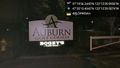
Auburn GC @47.3362,-122.2082


