Difference between revisions of "2016-04-25 47 -122"
From Geohashing
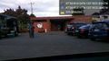
imported>Thomcat ([live picture]Geohasher [http://www.openstreetmap.org/?lat=47.61378100&lon=-122.30883750&zoom=16&layers=B000FTF @47.6138,-122.3088]) |
imported>Thomcat ([live picture]Zoom on sign [http://www.openstreetmap.org/?lat=47.61376490&lon=-122.30885470&zoom=16&layers=B000FTF @47.6138,-122.3089]) |
||
| Line 39: | Line 39: | ||
Image:2016-04-25_47_-122_thomcat_1461634119353.jpg|Geohasher [http://www.openstreetmap.org/?lat=47.61378100&lon=-122.30883750&zoom=16&layers=B000FTF @47.6138,-122.3088] | Image:2016-04-25_47_-122_thomcat_1461634119353.jpg|Geohasher [http://www.openstreetmap.org/?lat=47.61378100&lon=-122.30883750&zoom=16&layers=B000FTF @47.6138,-122.3088] | ||
| + | |||
| + | Image:2016-04-25_47_-122_thomcat_1461634171456.jpg|Zoom on sign [http://www.openstreetmap.org/?lat=47.61376490&lon=-122.30885470&zoom=16&layers=B000FTF @47.6138,-122.3089] | ||
</gallery> | </gallery> | ||
Revision as of 01:29, 26 April 2016
| Mon 25 Apr 2016 in Seattle: 47.6137815, -122.3088384 geohashing.info google osm bing/os kml crox |
Location
On 18th avenue, across from the TT Minor building on Seattle's Capitol Hill.
Participants
Plans
Stop by after baseball, then head north to home.
Expedition
This hashpoint is on the street east of the former T.T. Minor elementary, now the home of the Hamlin Robinson School. This area is known as Cherry Hill.
Tracklog
Photos
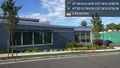
The old Hamlin Robinson school @47.5877,-122.3067
Pit stop @47.5995,-122.2997
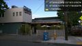
Chuck's! @47.6127,-122.3062
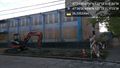
Under construction @47.6140,-122.3089

Geohasher @47.6138,-122.3088
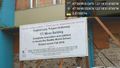
Zoom on sign @47.6138,-122.3089


Achievements