Difference between revisions of "2016-04-30 -31 -64"
imported>Onicofago (Created page with "{{meetup graticule | lat=-31 | lon=-64 | date=2016-04-30 }} __NOTOC__ == Location == I a field 1km East of RP5, near Villa del Prado. Córdoba, Argentina. == Participants =...") |
imported>FippeBot m (Location) |
||
| (2 intermediate revisions by one other user not shown) | |||
| Line 21: | Line 21: | ||
== Photos == | == Photos == | ||
<gallery perrow="5"> | <gallery perrow="5"> | ||
| + | Image:2016-04-30_-31,-64_sierras.jpg | View of the sierras near Alta Gracia | ||
| + | Image:2016-04-30_-31,-64_mud.jpg | Again, muddy roads! | ||
| + | Image:2016-04-30_-31,-64_street.jpg | Actually, it's not a field, but a street | ||
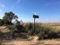
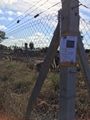
| + | Image:2016-04-30_-31,-64_arriving.jpg | Arriving to the hashpoint, on the left where the fence ends | ||
| + | Image:2016-04-30_-31,-64_dogs.jpg | Some hashdogs that came to play with us | ||
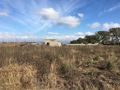
Image:2016-04-30_-31,-64_hash.jpg | View of the hashpoint | Image:2016-04-30_-31,-64_hash.jpg | View of the hashpoint | ||
| + | Image:2016-04-30_-31,-64_proof.jpg | Coordinates reached! | ||
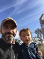
| + | Image:2016-04-30_-31,-64_hashcot.jpg | Juan at the hashpoint | ||
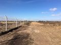
| + | Image:2016-04-30_-31,-64_poster.jpg | Poster in place | ||
| + | Image:2016-04-30_-31,-64_grin.jpg | Mandatory Stupid Grin | ||
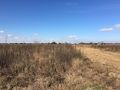
| + | Image:2016-04-30_-31,-64_viewn.jpg | View to the North from the hashpoint | ||
| + | Image:2016-04-30_-31,-64_viewe.jpg | View to the East from the hashpoint | ||
| + | Image:2016-04-30_-31,-64_views.jpg | View to the South from the hashpoint | ||
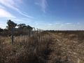
| + | Image:2016-04-30_-31,-64_vieww.jpg | View to the West from the hashpoint | ||
</gallery> | </gallery> | ||
| Line 37: | Line 50: | ||
[[Category:Expeditions with photos]] | [[Category:Expeditions with photos]] | ||
[[Category:Coordinates reached]] | [[Category:Coordinates reached]] | ||
| + | {{location|AR|X}} | ||
Latest revision as of 00:23, 16 August 2019
| Sat 30 Apr 2016 in -31,-64: -31.6232513, -64.3795681 geohashing.info google osm bing/os kml crox |
Location
I a field 1km East of RP5, near Villa del Prado. Córdoba, Argentina.
Participants
- Onicofago
- Juan, my son and hashcot
Plans
Home graticule. Seems reachable by car, approx. 30 km from the city.
Expedition
Drove there before lunch, with the kid. Area still muddy because of recent rains. Took RP5 heading to Alta Gracia, and then returned and turned right on a dirt road that led to the vicinity of the hash.
Map showed a field but in fact the area was a site under construction, with several houses being built in their initial stages of construction. The hash was located right next to the wire fence of one of these sites. We located the poster, took some pictures, did a little happy dance with Juan and returned home. Success!
Photos
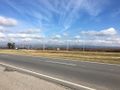
View of the sierras near Alta Gracia
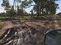
Again, muddy roads!
Actually, it's not a field, but a street
Arriving to the hashpoint, on the left where the fence ends
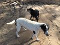
Some hashdogs that came to play with us
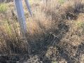
View of the hashpoint
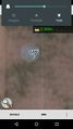
Coordinates reached!
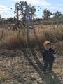
Juan at the hashpoint
Poster in place
Mandatory Stupid Grin
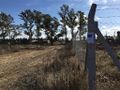
View to the North from the hashpoint
View to the East from the hashpoint
View to the South from the hashpoint
View to the West from the hashpoint


Achievements
Onicofago earned the Land geohash achievement
|