Difference between revisions of "2016-07-03 52 10"
From Geohashing
imported>GeorgDerReisende (expedition report for Schellerten-Wendhausen) |
imported>FippeBot m (Location) |
||
| Line 57: | Line 57: | ||
[[Category:Coordinates reached]] | [[Category:Coordinates reached]] | ||
| + | {{location|DE|NI|HI}} | ||
Latest revision as of 00:55, 16 August 2019
| Sun 3 Jul 2016 in 52,10: 52.1492068, 10.0573026 geohashing.info google osm bing/os kml crox |
Location
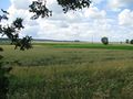
The hash lay on an edge of a field north of Wendhausen.
Participants
Plans
Hitchhiking and walking.
Expedition
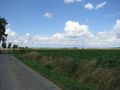
I left home at 9 o'clock, started at 10 and arrived at 11:30 at the service station Hildesheimer Börde. I walked around Wendhausen and again I made some research for OpenStreetMap and took some photos for Wikimedia. Then I walked to the hash, this site I had already passed on the way to 2014-10-24 52 10. Today I could reach the hash, it lay two meters behind a tree on the edge of the field. Afterwards I walked to the southbound service station and hitchhiked home.
Photos
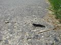
Will this become one of those dangerous velociraptors?
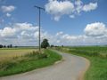
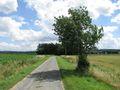
Way to the hash
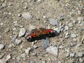
Another velociraptor?
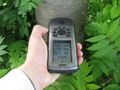
Proof.
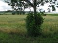
Tree.
north
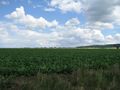
east
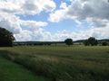
south
west

the geohasher
view to the hash from north


Achievements
GeorgDerReisende earned the Thumbs Up Geohash Achievement
|
This user earned the OpenStreetMap achievement
|
GeorgDerReisende earned the Déjà Vu Geohash Achievement
|