Difference between revisions of "2016-07-13 41 2"
From Geohashing
imported>Tads (Created page with "{{subst:Expedition |lat = 41 |lon = 2 |date = 2016-07-13 }}") |
imported>Tads |
||
| Line 1: | Line 1: | ||
| − | |||
| − | |||
| − | |||
| − | |||
| − | |||
| − | |||
| − | |||
| − | |||
| − | |||
| − | |||
{{meetup graticule | {{meetup graticule | ||
| lat=41 | | lat=41 | ||
| Line 19: | Line 9: | ||
== Location == | == Location == | ||
| − | + | Parc de l'Oreneta in Barcelona | |
== Participants == | == Participants == | ||
| − | + | [[User:Tads|Tads]] ([[User talk:Tads|talk]]) | |
| − | |||
== Plans == | == Plans == | ||
| − | + | Visit the park and find the hashpoint on my way back from work to the hotel. | |
| + | |||
== Expedition == | == Expedition == | ||
| − | + | ToDo | |
| − | |||
| − | |||
== Photos == | == Photos == | ||
| − | |||
| − | |||
| − | |||
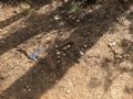
<gallery perrow="5"> | <gallery perrow="5"> | ||
| + | Image:tads_2016-07-13_41_2_mark.jpg | XKCD mark | ||
| + | Image:tads_2016-07-13_41_2_proof.jpg | GPS proof | ||
| + | more to come | ||
</gallery> | </gallery> | ||
| + | |||
== Achievements == | == Achievements == | ||
{{#vardefine:ribbonwidth|800px}} | {{#vardefine:ribbonwidth|800px}} | ||
| − | |||
<!-- =============== USEFUL CATEGORIES FOLLOW ================ | <!-- =============== USEFUL CATEGORIES FOLLOW ================ | ||
| − | Delete the next line ONLY if you have chosen the appropriate categories below. If you are unsure, don't worry. People will read your report and help you with the classification. --> | + | Delete the next line ONLY if you have chosen the appropriate categories below. If you are unsure, don't worry. People will read your report and help you with the classification. |
| + | --> | ||
[[Category:New report]] | [[Category:New report]] | ||
| − | |||
| − | |||
| − | |||
| − | |||
| − | |||
| − | |||
| − | |||
| − | |||
| − | |||
| − | |||
[[Category:Expeditions]] | [[Category:Expeditions]] | ||
| − | |||
[[Category:Expeditions with photos]] | [[Category:Expeditions with photos]] | ||
| − | |||
| − | |||
| − | |||
| − | |||
| − | |||
[[Category:Coordinates reached]] | [[Category:Coordinates reached]] | ||
| − | |||
| − | |||
| − | |||
| − | |||
| − | |||
| − | |||
| − | |||
| − | |||
| − | |||
| − | |||
| − | |||
| − | |||
| − | |||
| − | |||
| − | |||
| − | |||
| − | |||
| − | |||
Revision as of 17:33, 13 July 2016
| Wed 13 Jul 2016 in 41,2: 41.3992122, 2.1119300 geohashing.info google osm bing/os kml crox |
Location
Parc de l'Oreneta in Barcelona
Participants
Plans
Visit the park and find the hashpoint on my way back from work to the hotel.
Expedition
ToDo
Photos
XKCD mark
- Tads 2016-07-13 41 2 proof.jpg
GPS proof
- More to come
