2016-07-15 -37 145
| Fri 15 Jul 2016 in -37,145: -37.5830345, 145.1722530 geohashing.info google osm bing/os kml crox |
Location
In a field near Arthurs Creek, north of Melbourne
Participants
Expedition
Lachie suggested going on a bike ride today, as I woke up from having crashed at my friends' place in Ivanhoe (I'd missed the last train). So I had to drive back to my home, get bike-ready, then head out to Lachie's place in Coburb to return my car to him (long story). We had a coffee and headed out.
Using various bike paths to escape the city, we went through the suburban wilderness of the Commuter Class towards the hash. After quite a while, we turned off the main road towards the Arthurs Creek cemetery. The sky was cloudy and air windy - a typical Melbourne winter's day.
We locked up our bikes at the cemetery and proceeded on foot, pausing only to clamber over some barbed wire fences. Our arrival at the hash repelled a swarm of kangaroos, which bounded off over the undulating hills beneath the high voltage lines. We took photos at the hashpoint and departed.
On our way back we decided to climb up the back of Kinglake and come down the Melbourne side. Sweeping views of the city, and the fire destruction from 2009, bombarded us.
We made it to Hurstbridge station after dark, and had to wait 45 minutes for the next train. Because I had a dinner to go to, I had to wash myself and my clothes in the public toilets there and take the cleats out of my shoes so I could go straight there. It was a cold train ride back to town.
here is the route we took. 105 kms.
Photos
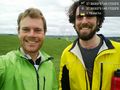
Felix and Lachie at the Arthurs Creek geohash @-37.5830,145.1722
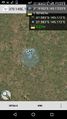
GPS proof - 21cm! @-37.5830,145.1722
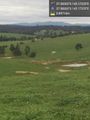
Kangaroos flee our arrival @-37.5830,145.1722


Achievements
Felix Dance and Lachie earned the Bicycle geohash achievement
|