Difference between revisions of "2016-08-15 52 1"
From Geohashing
imported>Sourcerer m (→Plans) |
imported>Sourcerer m ([live picture] Arrived. [http://www.openstreetmap.org/?lat=52.41464496&lon=1.29410148&zoom=16&layers=B000FTF @52.4146,1.2941]) |
||
| Line 25: | Line 25: | ||
== Photos == | == Photos == | ||
<gallery caption="Photo Gallery" perrow="3"> | <gallery caption="Photo Gallery" perrow="3"> | ||
| + | |||
| + | Image:2016-08-15_52_1_Sourcerer_1471293184000.jpg | Arrived. [http://www.openstreetmap.org/?lat=52.41464496&lon=1.29410148&zoom=16&layers=B000FTF @52.4146,1.2941] | ||
</gallery> | </gallery> | ||
Revision as of 20:35, 15 August 2016
| Mon 15 Aug 2016 in Norwich, UK: 52.4146528, 1.2940789 geohashing.info google osm bing/os kml crox |
Location
A field north of Harleston, Norfolk, UK.
Participants
Plans
Go at dusk
Expedition
Photos
- Photo Gallery
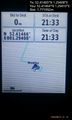
Arrived. @52.4146,1.2941

Achievements
Expeditions and Plans
| 2016-08-15 | ||
|---|---|---|
| Norwich, United Kingdom | Sourcerer | A field north of Harleston, Norfolk, UK. |
| Utrecht, Netherlands | JwB | in a forest near Almere |
| Manchester, United Kingdom | PaulS | Somewhere |
Sourcerer's Expedition Links
2016-08-14 52 1 - 2016-08-15 52 1 - 2016-08-16 52 1 - KML file download of Sourcerer's expeditions for use with Google Earth.