Difference between revisions of "2016-09-09 50 8"
imported>DODO (Created page with "{{subst:Expedition |lat = 50 |lon = 8 |date = 2016-09-09 }}") |
imported>FippeBot m (Location) |
||
| (10 intermediate revisions by one other user not shown) | |||
| Line 20: | Line 20: | ||
== Location == | == Location == | ||
<!-- where you've surveyed the hash to be --> | <!-- where you've surveyed the hash to be --> | ||
| + | A meadow near Heringen. | ||
== Participants == | == Participants == | ||
<!-- who attended: If you link to your wiki user name in this section, your expedition will be picked up by the various statistics generated for geohashing. You may use three tildes ~ as a shortcut to automatically insert the user signature of the account you are editing with. | <!-- who attended: If you link to your wiki user name in this section, your expedition will be picked up by the various statistics generated for geohashing. You may use three tildes ~ as a shortcut to automatically insert the user signature of the account you are editing with. | ||
--> | --> | ||
| + | [[User:DODO|DODO]] | ||
== Plans == | == Plans == | ||
<!-- what were the original plans --> | <!-- what were the original plans --> | ||
| + | A class reunion was scheduled for 2016-09-10 and so I wanted to visit my mother. As I had some days off, I planned to go hashing on the following days, and took my bike with me. As I had to ride to Neuwied, I planned to go as near to the hash as possible by train and continue my way to my mother via the hash by bike. | ||
== Expedition == | == Expedition == | ||
| − | + | The closest station to the hash was at Niederbrechen (what could be read as breakdown). It wasn't to easy to reach. I started at Speyer station at 10:02 but couldn't start riding before half past one. Half an hour later I was already near the hash. I had to leave the road for some 100 meters, especially since the hash lies much higher than the road. Then I reached a grassland with many apple trees. I parked my bike, walked a little and that was it. It was a great view from the hp, and I admit that I took an apple for me. Then I continued my way for the remaining 70 kilometers. | |
| + | |||
| + | I don't want to bore you with the description of the trip. Just so much: I was surprised, how much traffic was on the Westerwald (what this low mountain range is called). And just when I got really thirsty I found a very small crafted brewery in the little village Grenzau and got an excellent IPA. The next mountain was much easier to climb :-) But then my tablet ran out of power and as I hadn't any other maps with me, I had no idea where I should go. For heavens sake I was already close to Sayn, from where I knew the way to my mothers house very good. I just had to go down to the valley. I've chosen the right way and after a short while I found myself on a narrow and steep path, even with stairs in it. But although I had to push my bike (or hold it back), I soon reached the ground of the valley and really was in Sayn. Just 20 minutes later I reached my mothers home at 7 pm. | ||
== Tracklog == | == Tracklog == | ||
| − | + | [https://www.komoot.de/tour/12206272 the first 62 kilometers], before I run out of power. And I did ride 157 kilometers by train (and then only 7 kilometers to the hash, what qualifies for a public transport achievement). | |
== Photos == | == Photos == | ||
| − | < | + | |
| − | Image: | + | <gallery perrow="6"> |
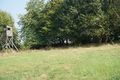
| − | -- | + | Image:2016-09-09 50 8-01.jpg|natural reserve for the neglected grassland |
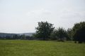
| − | + | Image:2016-09-09 50 8-03.jpg|view to the hash | |
| + | Image:2016-09-09 50 8-04.jpg|apples | ||
| + | Image:2016-09-09 50 8-02.jpg|view to the west | ||
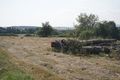
| + | Image:2016-09-09 50 8-06.jpg|the east | ||
| + | Image:2016-09-09 50 8-13.jpg|the north | ||
| + | Image:2016-09-09 50 8-08.jpg|and the hasher | ||
| + | Image:2016-09-09 50 8-15.jpg|and -ast but not least - the bike | ||
| + | Image:2016-09-09 50 8-18.jpg|castle Ardeck, one of the castles on my way | ||
| + | Image:2016-09-09 50 8-20.jpg|castle Diez | ||
| + | Image:2016-09-09 50 8-23.jpg|and ice cream in Diez | ||
</gallery> | </gallery> | ||
| Line 45: | Line 59: | ||
<!-- Add any achievement ribbons you earned below, or remove this section --> | <!-- Add any achievement ribbons you earned below, or remove this section --> | ||
| − | + | {{land geohash | |
| − | + | | latitude = 50 | |
| − | + | | longitude =8 | |
| + | | date = 2016-09-09 | ||
| + | | name = DODO | ||
| + | }} | ||
| − | + | {{Public transport geohash | |
| − | + | | latitude = 50 | |
| − | + | | longitude = 8 | |
| − | + | | date = 2016-09-09 | |
| − | + | | name = DODO | |
| − | + | }} | |
| − | |||
| − | |||
[[Category:Expeditions]] | [[Category:Expeditions]] | ||
| − | |||
| − | |||
| − | |||
| − | |||
| − | |||
| − | |||
| − | |||
[[Category:Coordinates reached]] | [[Category:Coordinates reached]] | ||
| − | + | {{location|DE|HE|LM}} | |
| − | |||
| − | |||
| − | |||
| − | |||
| − | |||
| − | |||
| − | |||
| − | |||
| − | |||
| − | |||
| − | |||
| − | |||
| − | |||
| − | |||
| − | |||
| − | |||
| − | |||
Latest revision as of 01:24, 16 August 2019
| Fri 9 Sep 2016 in 50,8: 50.3238606, 8.1185337 geohashing.info google osm bing/os kml crox |
Location
A meadow near Heringen.
Participants
Plans
A class reunion was scheduled for 2016-09-10 and so I wanted to visit my mother. As I had some days off, I planned to go hashing on the following days, and took my bike with me. As I had to ride to Neuwied, I planned to go as near to the hash as possible by train and continue my way to my mother via the hash by bike.
Expedition
The closest station to the hash was at Niederbrechen (what could be read as breakdown). It wasn't to easy to reach. I started at Speyer station at 10:02 but couldn't start riding before half past one. Half an hour later I was already near the hash. I had to leave the road for some 100 meters, especially since the hash lies much higher than the road. Then I reached a grassland with many apple trees. I parked my bike, walked a little and that was it. It was a great view from the hp, and I admit that I took an apple for me. Then I continued my way for the remaining 70 kilometers.
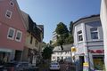
I don't want to bore you with the description of the trip. Just so much: I was surprised, how much traffic was on the Westerwald (what this low mountain range is called). And just when I got really thirsty I found a very small crafted brewery in the little village Grenzau and got an excellent IPA. The next mountain was much easier to climb :-) But then my tablet ran out of power and as I hadn't any other maps with me, I had no idea where I should go. For heavens sake I was already close to Sayn, from where I knew the way to my mothers house very good. I just had to go down to the valley. I've chosen the right way and after a short while I found myself on a narrow and steep path, even with stairs in it. But although I had to push my bike (or hold it back), I soon reached the ground of the valley and really was in Sayn. Just 20 minutes later I reached my mothers home at 7 pm.
Tracklog
the first 62 kilometers, before I run out of power. And I did ride 157 kilometers by train (and then only 7 kilometers to the hash, what qualifies for a public transport achievement).
Photos
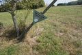
natural reserve for the neglected grassland
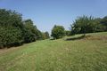
view to the hash
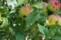
apples
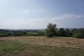
view to the west
the east
the north
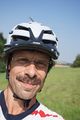
and the hasher
and -ast but not least - the bike
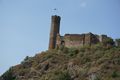
castle Ardeck, one of the castles on my way
castle Diez
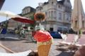
and ice cream in Diez


Achievements
DODO earned the Land geohash achievement
|
DODO earned the Public transport geohash achievement
|