Difference between revisions of "2016-11-28 52 1"
From Geohashing
imported>Sourcerer (→Planning) |
imported>Sourcerer m ([live picture] Arrived. [http://www.openstreetmap.org/?lat=52.78998792&lon=1.03717268&zoom=16&layers=B000FTF @52.7900,1.0372]) |
||
| Line 25: | Line 25: | ||
== Photos == | == Photos == | ||
<gallery caption="Photo Gallery" perrow="3"> | <gallery caption="Photo Gallery" perrow="3"> | ||
| + | |||
| + | Image:2016-11-28_52_1_Sourcerer_1480372680575.jpg | Arrived. [http://www.openstreetmap.org/?lat=52.78998792&lon=1.03717268&zoom=16&layers=B000FTF @52.7900,1.0372] | ||
</gallery> | </gallery> | ||
Revision as of 22:39, 28 November 2016
| Mon 28 Nov 2016 in Norwich, UK: 52.7899887, 1.0371662 geohashing.info google osm bing/os kml crox |
Location
A field east of Foulsham, Norfolk, UK.
Participants
Plans
ETA 23:30.
Expedition
Photos
- Photo Gallery
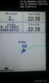
Arrived. @52.7900,1.0372

Achievements
Expeditions and Plans
| 2016-11-28 | ||
|---|---|---|
| Norwich, United Kingdom | Sourcerer | A field east of Foulsham, Norfolk, UK. |
Sourcerer's Expedition Links
2016-11-27 52 1 - 2016-11-28 52 1 - 2016-11-29 52 1 - KML file download of Sourcerer's expeditions for use with Google Earth.