Difference between revisions of "2016-12-10 52 1"
From Geohashing
imported>Sourcerer (→Planning) |
imported>Sourcerer m ([live picture] Arrived. [http://www.openstreetmap.org/?lat=52.23161638&lon=1.55048847&zoom=16&layers=B000FTF @52.2316,1.5505]) |
||
| Line 25: | Line 25: | ||
== Photos == | == Photos == | ||
<gallery caption="Photo Gallery" perrow="3"> | <gallery caption="Photo Gallery" perrow="3"> | ||
| + | |||
| + | Image:2016-12-10_52_1_Sourcerer_1481411753480.jpg | Arrived. [http://www.openstreetmap.org/?lat=52.23161638&lon=1.55048847&zoom=16&layers=B000FTF @52.2316,1.5505] | ||
</gallery> | </gallery> | ||
Revision as of 23:17, 10 December 2016
| Sat 10 Dec 2016 in Norwich, UK: 52.2316142, 1.5504707 geohashing.info google osm bing/os kml crox |
Location
A field west of Theberton, Suffolk, UK.
Participants
Plans
One of two spanning midnight - 2016-12-10 52 1 - 2016-12-11 52 1 - ETA 23:25.
Expedition
Photos
- Photo Gallery
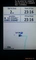
Arrived. @52.2316,1.5505

Achievements
Expeditions and Plans
| 2016-12-10 | ||
|---|---|---|
| Düsseldorf, Germany | pah, NB | In the bushes between two streets near Willich. |
| Kassel, Germany | GeorgDerReisende | The hash lay in the forest south of Wellerode. |
| Norwich, United Kingdom | Sourcerer | A field west of Theberton, Suffolk, UK. |
| Leeuwarden, Netherlands | FelixTheCat | Tzummarum, Friesland province, the Netherlands. |
Sourcerer's Expedition Links
2016-12-05 52 1 - 2016-12-10 52 1 - 2016-12-11 52 1 - KML file download of Sourcerer's expeditions for use with Google Earth.