Difference between revisions of "2017-01-01 59 17"
From Geohashing
imported>Per S ([live] Bam) |
imported>FippeBot m (Location) |
||
| (One intermediate revision by one other user not shown) | |||
| Line 1: | Line 1: | ||
| + | {| width="100%" border=0 cellpadding=0 cellspacing=0 style="border: 0; border-collapse: collapse; border-spacing: 0; margin: 0; padding: 0" | ||
| − | + | | align="left" valign="top" style="padding: 0.5em 1em 0.5em 0" | [[Image:2017-01-01_59_17_09 The Geohashers.jpg|467px]] | |
| − | + | | align="right" valign="top" | {{meetup graticule | |
| − | |||
| − | |||
| − | |||
| − | |||
| − | |||
| − | |||
| − | {{meetup graticule | ||
| lat=59 | | lat=59 | ||
| lon=17 | | lon=17 | ||
| date=2017-01-01 | | date=2017-01-01 | ||
| + | | graticule_name=Uppsala | ||
| + | | graticule_link=Uppsala, Sweden | ||
}} | }} | ||
| − | + | |} | |
| + | |||
__NOTOC__ | __NOTOC__ | ||
== Location == | == Location == | ||
| − | + | In a memorial garden in western Jakobsberg. | |
== Participants == | == Participants == | ||
| − | + | * [[User:Per S|Per S]] | |
| − | + | * iA | |
== Plans == | == Plans == | ||
| − | + | Go there by car, hopefully before it gets dark. | |
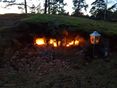
== Expedition == | == Expedition == | ||
| − | + | We went there by car and got there while there was still some light. We checked the memorial garden, and found a suitable hash tree. | |
| − | |||
| − | |||
| − | |||
| − | |||
| − | |||
== Photos == | == Photos == | ||
| − | < | + | <gallery widths=117px perrow="5"> |
| − | Image: | + | Image:2017-01-01_59_17_01 Todays Citation.jpg | Today's [[Citation Needed|Citation]] |
| − | -- | + | Image:2017-01-01_59_17_02 Parked.jpg | Parked |
| − | + | Image:2017-01-01_59_17_03 Memorial Garden Sign.jpg | Memorial Garden Sign | |
| + | Image:2017-01-01_59_17_04 Memorial Garden.jpg | Memorial Garden | ||
| + | Image:2017-01-01_59_17_05 Memorial Garden.jpg | Memorial Garden | ||
| + | Image:2017-01-01_59_17_06 Geohasher.jpg | Geohasher | ||
| + | Image:2017-01-01_59_17_07 Marker.jpg | Marker | ||
| + | Image:2017-01-01_59_17_08 Coordinates Reached.jpg | Coordinates Reached | ||
| + | Image:2017-01-01_59_17_09 The Geohashers.jpg | The Geohashers | ||
</gallery> | </gallery> | ||
== Achievements == | == Achievements == | ||
| − | |||
| − | |||
| − | |||
| − | |||
| − | |||
| − | |||
| − | |||
| − | |||
| − | |||
| − | |||
| − | |||
| − | |||
| − | |||
| − | |||
| − | |||
| − | |||
[[Category:Expeditions]] | [[Category:Expeditions]] | ||
| − | |||
[[Category:Expeditions with photos]] | [[Category:Expeditions with photos]] | ||
| − | |||
| − | |||
| − | |||
| − | |||
| − | |||
[[Category:Coordinates reached]] | [[Category:Coordinates reached]] | ||
| − | + | {{location|SE|AB}} | |
| − | |||
| − | |||
| − | |||
| − | |||
| − | |||
| − | |||
| − | |||
| − | |||
| − | |||
| − | |||
| − | |||
| − | |||
| − | |||
| − | |||
| − | |||
| − | |||
| − | |||
Latest revision as of 01:57, 16 August 2019

|
| ||||||
Location
In a memorial garden in western Jakobsberg.
Participants
- Per S
- iA
Plans
Go there by car, hopefully before it gets dark.
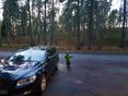
Expedition
We went there by car and got there while there was still some light. We checked the memorial garden, and found a suitable hash tree.
Photos
Today's Citation
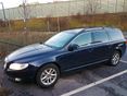
Parked
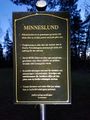
Memorial Garden Sign
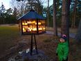
Memorial Garden
Memorial Garden
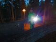
Geohasher
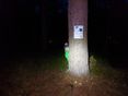
Marker
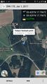
Coordinates Reached
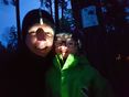
The Geohashers


