Difference between revisions of "2017-02-05 53 8"
imported>Kerko (Created page with "{{meetup graticule | lat=53 | lon=8 | date=2017-02-05 }} __NOTOC__ == Location == A field surrounded by diggers near the nature reserve Vehnemoor. == Participants == *Use...") |
imported>FippeBot m (Location) |
||
| Line 49: | Line 49: | ||
[[Category:Expedition without GPS]] | [[Category:Expedition without GPS]] | ||
[[Category:Coordinates reached]] | [[Category:Coordinates reached]] | ||
| + | {{location|DE|NI|CLP}} | ||
Latest revision as of 02:06, 16 August 2019
| Sun 5 Feb 2017 in 53,8: 53.0435171, 8.0398548 geohashing.info google osm bing/os kml crox |
Location
A field surrounded by diggers near the nature reserve Vehnemoor.
Participants
Plans
Because the geohash was close to my home, I tried to reach it by bike.
Expedition
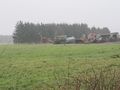
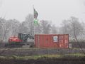
I rode along the Küstenkanal for some kilometres, then I crossed the nature reserve Vehnemoor. It has an impressive size, although I already had been there one year ago. (Oldenburg, with it’s hundred thousands inhabitants, isn’t much greater.) In the past someone mined peat there, but a few days ago they decided to stop peat mining in Niedersachsen. There are still some lonely diggers which I tried to catch with the camera. The field railway looks adventurous and the road there tries to gulp your bike’s tires if you are too slow. After I had reached the geohash, I spotted some more diggers. To prove the location, I used nearby street signs again, since STUPIDMAP V2.0 isn’t suited well for proving anything. Proof of date: Upload time of picture and my promise that I wasn’t there already saturday.
Photos
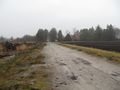
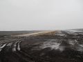
Naturschutzgebiet Vehnemoor, looking back to where I came from.
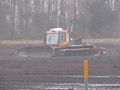
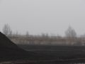
The first digger.
The muddy road. Be fast or it will keep your bike. The sign suggests trains of the wrong size.
There‘s a speed limit when crossing wood heaps.
“Pisten Bully”, I count it as digger.
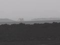
Another digger at 24x zoom.
Are there security standards for field railways?
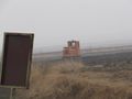
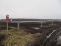
Looks like a train station. I found no ticket terminals…
An orange vehicle at 12x zoom.
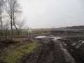
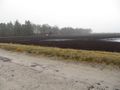
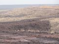
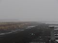
The other side of Naturschutzgebiet Vehnemoor.
I couldn’t see anything at the horizon, too.
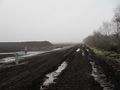
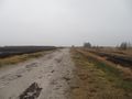
This road is even worse. After I placed a foot there it was difficult to get it back.
That could work, but uncommon for today’s public transport.
I can’t explain what these tubes were used for.
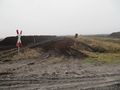
Barriers are sometimes next to the way. If you are in trouble, remember this picture and try another way.
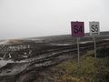
I can’t understand such signs.
A stationary alternative to STUPIDMAP.

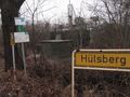
Me at Lutzweg/Korsorsstraße.
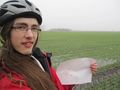
Me at the geohash.
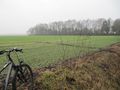
Geohashes are invisible sometimes, but it is somewhere there.
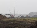
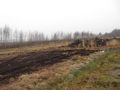
Other diggers near the geohash.
Even more diggers. These are in Habern I.
One last digger together with advertising on the other side of the road.


