Difference between revisions of "2017-03-11 51 11"
imported>Jens (→Photos) |
imported>Reinhard (someone else went) |
||
| Line 11: | Line 11: | ||
== Participants == | == Participants == | ||
* [[user:Jens|Jens]] and Räbe | * [[user:Jens|Jens]] and Räbe | ||
| + | * [[user:Reinhard|Reinhard]] | ||
| − | == Expedition == | + | == Expedition: Jens == |
My first hash tour this year. No need to say that going there was Juja's idea. I tried a new kind of excuse. Because it's Lent at the moment I invented Hash point fasting. But it has not really been accepted. | My first hash tour this year. No need to say that going there was Juja's idea. I tried a new kind of excuse. Because it's Lent at the moment I invented Hash point fasting. But it has not really been accepted. | ||
| − | Well, but it was Saturday and I had time, the weather was fine, the distance not | + | Well, but it was Saturday and I had time, the weather was fine, the distance not too long. So I didn't stand on my new kind of fasting, saddled my bike and cycled to the point, located just some meters beside the Saale-cycleway. Of course these “some meters” led straight up a hill, but everything else would have been a surprise. |
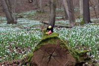
The hash point was marked by the root of a fallen tree, so it was easy to find in an ocean of spring snowflakes. I took some photos and went home again. | The hash point was marked by the root of a fallen tree, so it was easy to find in an ocean of spring snowflakes. I took some photos and went home again. | ||
| − | |||
| − | |||
{{gallery|width=200|height=200|lines=2 | {{gallery|width=200|height=200|lines=2 | ||
| Line 30: | Line 29: | ||
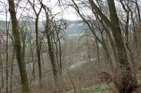
|Image:170311 51 11 06.JPG|View from the point down to the street | |Image:170311 51 11 06.JPG|View from the point down to the street | ||
}} | }} | ||
| + | |||
| + | == Expedition: Reinhard == | ||
| + | |||
| + | My first hash tour this year. No need to say that going there was my idea. I didn't try any kind of excuse. There's nothing like Hash point fasting. There never was. | ||
| + | |||
| + | Well, it was Saturday and I had time, the weather was fine, the distance not too long. So as usual I saddled my bike and cycled to the point, located just some meters beside the Saale-cycleway. Of course these “some meters” led straight up a hill, but everything else would have been a surprise. | ||
| + | |||
| + | Couldn't find any hash point mark. I took some photos and went home again after continuing northbound till Großheringen. | ||
| + | |||
| + | {{gallery|width=200|height=200|lines=1 | ||
| + | |20170311-51N11E-01.jpg|Approaching | ||
| + | |20170311-51N11E-02.jpg|Parking | ||
| + | |20170311-51N11E-03.jpg|Hashdancing | ||
| + | |20170311-51N11E-04.jpg|Selfieing | ||
| + | }} | ||
| + | |||
| + | '''Tracklog:''' [https://www.strava.com/activities/896128376 Strava activity] | ||
| + | |||
| + | [https://www.relive.cc/view/896128376 ... or watch an automatic video animation of that expedition.] | ||
| + | |||
| + | P.S.: Big thanks to Jens for preparing this page for me! | ||
| + | |||
[[Category:Expeditions]] | [[Category:Expeditions]] | ||
[[Category:Expeditions with photos]] | [[Category:Expeditions with photos]] | ||
[[Category:Coordinates reached]] | [[Category:Coordinates reached]] | ||
Revision as of 20:40, 11 March 2017
| Sat 11 Mar 2017 in 51,11: 51.0352229, 11.6818387 geohashing.info google osm bing/os kml crox |
Location
In a forest near Wichmar
Participants
Expedition: Jens
My first hash tour this year. No need to say that going there was Juja's idea. I tried a new kind of excuse. Because it's Lent at the moment I invented Hash point fasting. But it has not really been accepted.
Well, but it was Saturday and I had time, the weather was fine, the distance not too long. So I didn't stand on my new kind of fasting, saddled my bike and cycled to the point, located just some meters beside the Saale-cycleway. Of course these “some meters” led straight up a hill, but everything else would have been a surprise.
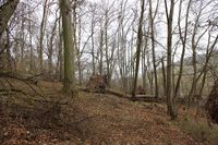
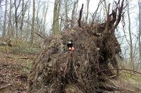
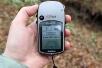
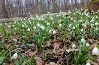
The hash point was marked by the root of a fallen tree, so it was easy to find in an ocean of spring snowflakes. I took some photos and went home again.
|
Expedition: Reinhard
My first hash tour this year. No need to say that going there was my idea. I didn't try any kind of excuse. There's nothing like Hash point fasting. There never was.
Well, it was Saturday and I had time, the weather was fine, the distance not too long. So as usual I saddled my bike and cycled to the point, located just some meters beside the Saale-cycleway. Of course these “some meters” led straight up a hill, but everything else would have been a surprise.
Couldn't find any hash point mark. I took some photos and went home again after continuing northbound till Großheringen.
|
Tracklog: Strava activity
... or watch an automatic video animation of that expedition.
P.S.: Big thanks to Jens for preparing this page for me!
