Difference between revisions of "2017-04-12 -37 145"
From Geohashing
imported>Thunk ([live picture]A better view of the mountain from the south side of Liverpool Road. [http://www.openstreetmap.org/?lat=-37.84757590&lon=145.31245090&zoom=16&layers=B000FTF @-37.8476,145.3125]) |
imported>Thunk ([live picture]Proper squishying procedure- be blonde. [http://www.openstreetmap.org/?lat=-37.85043820&lon=145.30675990&zoom=16&layers=B000FTF @-37.8504,145.3068]) |
||
| Line 51: | Line 51: | ||
Image:2017-04-12_-37_145_thunk_1491978031895.jpg|A better view of the mountain from the south side of Liverpool Road. [http://www.openstreetmap.org/?lat=-37.84757590&lon=145.31245090&zoom=16&layers=B000FTF @-37.8476,145.3125] | Image:2017-04-12_-37_145_thunk_1491978031895.jpg|A better view of the mountain from the south side of Liverpool Road. [http://www.openstreetmap.org/?lat=-37.84757590&lon=145.31245090&zoom=16&layers=B000FTF @-37.8476,145.3125] | ||
| + | |||
| + | Image:2017-04-12_-37_145_thunk_1491978642277.jpg|Proper squishying procedure- be blonde. [http://www.openstreetmap.org/?lat=-37.85043820&lon=145.30675990&zoom=16&layers=B000FTF @-37.8504,145.3068] | ||
</gallery> | </gallery> | ||
Revision as of 06:30, 12 April 2017
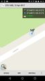
| Wed 12 Apr 2017 in -37,145: -37.8475072, 145.3123621 geohashing.info google osm bing/os kml crox |
Location
Participants
Plans
Expedition
- Hashpoint found and reached. A pretty easy roadside walk. -- Thunk (talk) @-37.8475,145.3124 06:17, 12 April 2017 (GMT+00:00)
Tracklog
Photos
Proof
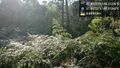
Trees near hash. @-37.8475,145.3124
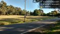
Roadside south @-37.8475,145.3124
Roadaide north @-37.8475,145.3124
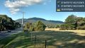
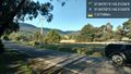
A better view of the mountain from the south side of Liverpool Road. @-37.8476,145.3125

Proper squishying procedure- be blonde. @-37.8504,145.3068


Achievements