Difference between revisions of "2017-05-12 52 5"
imported>Palmpje (Created page with "{{subst:Expedition |lat = 52 |lon = 5 |date = 2015-05-12 }}") |
imported>FippeBot m (Location) |
||
| (4 intermediate revisions by one other user not shown) | |||
| Line 1: | Line 1: | ||
| − | |||
| − | |||
| − | |||
| − | |||
| − | |||
| − | |||
| − | |||
| − | |||
| − | |||
| − | |||
{{meetup graticule | {{meetup graticule | ||
| lat=52 | | lat=52 | ||
| lon=5 | | lon=5 | ||
| − | | date= | + | | date=2017-05-12 |
}} | }} | ||
| − | |||
__NOTOC__ | __NOTOC__ | ||
== Location == | == Location == | ||
| − | + | In the woods near Driebergen | |
== Participants == | == Participants == | ||
| − | + | * [[User:Palmpje|Palmpje]] ([[User talk:Palmpje|talk]]) was keen on visiting this point. | |
| − | |||
== Plans == | == Plans == | ||
| − | + | Plan was to bring home a Geocaching trackable near the UMC and then continue to the hashpoint, hopefully arriving at hash-o-clock. | |
== Expedition == | == Expedition == | ||
| − | + | I ended up leaving home somewhat later than planned and then too a wrong exit on the A27 to make things worse. So I knew making it at hash-o-clock would be hard if I went to bring home the TB first. I did that anyway and then noticed that a challenge cache was only about 250 meters away. After that I walked back to the car and proceeded to a well known area. A few muddy spots from rather heavy rainfall earlier in the day and previous afternoon but otherwise easy walking to the vicinity of the hashpoint. I had to go off the paths for about 30 meters (not really allowed but nobody there to tell me) and after some dancing found the hashpoint to be next to a big tree. Success! | |
| − | |||
| − | |||
| − | |||
== Photos == | == Photos == | ||
| − | |||
| − | |||
| − | |||
<gallery perrow="5"> | <gallery perrow="5"> | ||
| + | Image:2017_05_12_52_5-001.JPG | Where was that? | ||
| + | 2017_05_12_52_5-002.JPG | The spot | ||
| + | 2017_05_12_52_5-004.JPG | View in all directions | ||
</gallery> | </gallery> | ||
| Line 44: | Line 29: | ||
{{#vardefine:ribbonwidth|800px}} | {{#vardefine:ribbonwidth|800px}} | ||
<!-- Add any achievement ribbons you earned below, or remove this section --> | <!-- Add any achievement ribbons you earned below, or remove this section --> | ||
| + | {{land geohash | ||
| + | | latitude = 52 | ||
| + | | longitude = 5 | ||
| + | | date = 2017-05-12 | ||
| + | | name = Palmpje | ||
| + | }} | ||
| − | |||
| − | |||
| − | |||
| − | |||
| − | |||
| − | |||
| − | |||
| − | |||
| − | |||
| − | |||
| − | |||
| − | |||
| − | |||
| − | |||
[[Category:Expeditions]] | [[Category:Expeditions]] | ||
| − | |||
[[Category:Expeditions with photos]] | [[Category:Expeditions with photos]] | ||
| − | |||
| − | |||
| − | |||
| − | |||
| − | |||
[[Category:Coordinates reached]] | [[Category:Coordinates reached]] | ||
| − | + | {{location|NL|UT}} | |
| − | |||
| − | |||
| − | |||
| − | |||
| − | |||
| − | |||
| − | |||
| − | |||
| − | |||
| − | |||
| − | |||
| − | |||
| − | |||
| − | |||
| − | |||
| − | |||
| − | |||
Latest revision as of 02:29, 16 August 2019
| Fri 12 May 2017 in 52,5: 52.0609050, 5.3182712 geohashing.info google osm bing/os kml crox |
Location
In the woods near Driebergen
Participants
Plans
Plan was to bring home a Geocaching trackable near the UMC and then continue to the hashpoint, hopefully arriving at hash-o-clock.
Expedition
I ended up leaving home somewhat later than planned and then too a wrong exit on the A27 to make things worse. So I knew making it at hash-o-clock would be hard if I went to bring home the TB first. I did that anyway and then noticed that a challenge cache was only about 250 meters away. After that I walked back to the car and proceeded to a well known area. A few muddy spots from rather heavy rainfall earlier in the day and previous afternoon but otherwise easy walking to the vicinity of the hashpoint. I had to go off the paths for about 30 meters (not really allowed but nobody there to tell me) and after some dancing found the hashpoint to be next to a big tree. Success!
Photos
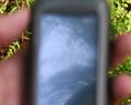
Where was that?
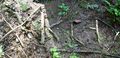
The spot
View in all directions


Achievements
Palmpje earned the Land geohash achievement
|