Difference between revisions of "2017-06-12 52 13"
imported>CamelCase m (→Expedition) |
imported>CamelCase (→Photos) |
||
| Line 41: | Line 41: | ||
== Photos == | == Photos == | ||
| − | |||
| − | |||
| − | |||
<gallery perrow="5"> | <gallery perrow="5"> | ||
| + | Image:2017-06-12_52_13_Train.jpg | From the train... | ||
| + | Image:2017-06-12_52_13_Station.jpg | ...to the bus. | ||
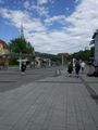
| + | Image:2017-06-12_52_13_Bus.jpg | We left the bus. | ||
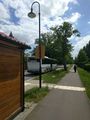
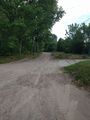
| + | Image:2017-06-12_52_13_Road.jpg | We walked down the road. | ||
| + | Image:2017-06-12_52_13_Tower.jpg | We walked by a cool communications tower. | ||
| + | Image:2017-06-12_52_13_Turn.jpg | We turned. | ||
| + | Image:2017-06-12_52_13_Whear.jpg | There was wheat. | ||
| + | Image:2017-06-12_52_13_Private.jpg | Onto a private road. | ||
| + | Image:2017-06-12_52_13_NotOnMap.jpg | That road was not on OSM. | ||
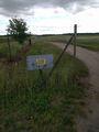
| + | Image:2017-06-12_52_13_Homeopathy.jpg | Smaller sign reads: 'homeopathy for animals' ^^ | ||
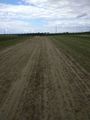
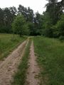
| + | Image:2017-06-12_52_13_Forest.jpg | forest track | ||
| + | Image:2017-06-12_52_13_Point.jpg | The hash lies in that direction. | ||
| + | Image:2017-06-12_52_13_Selfie.jpg | proof | ||
| + | Image:2017-06-12_52_13_Proof.jpg | the closest we could get | ||
| + | Image:2017-06-12_52_13_Back.jpg | turning back | ||
| + | Image:2017-06-12_52_13_Dealer.jpg | Squishy(tm) store | ||
| + | Image:2017-06-12_52_13_Squishy.jpg | the not so squishy Squishy(tm) | ||
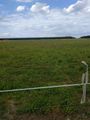
| + | Image:2017-06-12_52_13_Distance.jpg | just inside the 5km radius | ||
</gallery> | </gallery> | ||
Revision as of 17:07, 12 June 2017
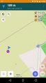
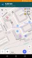
| Mon 12 Jun 2017 in 52,13: 52.6389378, 13.6409199 geohashing.info google osm bing/os kml crox |
Location
A field near Helenenau.
Participants
Plans
We are going to meet at the northernmost end of the platform the S2 departs from S Potsdamer Platz in the direction of S Bernau.
ETA: 15:00 You'll need a ticket which will allow you to travel through the Berlin ABC fare zones for two hours in either direction.
Expedition
Having arrived at Bernau station we took a bus to a stop near the hash point. We then walked the remaining two kilometers. First the map took us into a strawberry plantation onto a private road not leading anywhere. We returned onto the road we came from and found a way around that plantation, which led us into a horse ranch with no obvious way to reach the hash. Taking a detour through the forest we discovered that the hash point was inside a fenced area. We tried to get as close as we could, without trespassing, took a picture and turned back. On the way back we visited a local Squishy(tm) dealer and bought a Squishy each. They turned out not to taste very squishy.
Tracklog

Photos
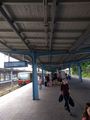
From the train...
...to the bus.
We left the bus.
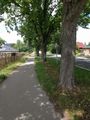
We walked down the road.
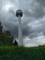
We walked by a cool communications tower.
We turned.
- 2017-06-12 52 13 Whear.jpg
There was wheat.
Onto a private road.
That road was not on OSM.
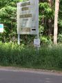
Smaller sign reads: 'homeopathy for animals' ^^
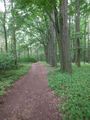
forest track
The hash lies in that direction.
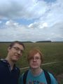
proof
the closest we could get
turning back
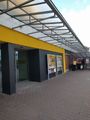
Squishy(tm) store
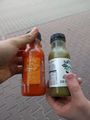
the not so squishy Squishy(tm)
just inside the 5km radius


