Difference between revisions of "2017-07-16 31 34"
imported>Yosef (→Expedition) |
imported>FippeBot m (Location) |
||
| (6 intermediate revisions by one other user not shown) | |||
| Line 20: | Line 20: | ||
== Location == | == Location == | ||
<!-- where you've surveyed the hash to be --> | <!-- where you've surveyed the hash to be --> | ||
| + | |||
| + | A field between Yad Binyamin and Mazkeret Batya | ||
The point looked like it was in a field north of highway 7 between Yad Binyamin and Mazkeret Batya with Gedera to the West. There was an important compound in the middle of the field and it looked like the point was just outside of that compound. | The point looked like it was in a field north of highway 7 between Yad Binyamin and Mazkeret Batya with Gedera to the West. There was an important compound in the middle of the field and it looked like the point was just outside of that compound. | ||
| Line 56: | Line 58: | ||
--> | --> | ||
<gallery perrow="5"> | <gallery perrow="5"> | ||
| + | Image:Screenshot_2017-07-16-10-16-21.png | GPS indicator | ||
| + | Image:Person.jpeg | I'm here! | ||
</gallery> | </gallery> | ||
| Line 64: | Line 68: | ||
<!-- =============== USEFUL CATEGORIES FOLLOW ================ | <!-- =============== USEFUL CATEGORIES FOLLOW ================ | ||
Delete the next line ONLY if you have chosen the appropriate categories below. If you are unsure, don't worry. People will read your report and help you with the classification. --> | Delete the next line ONLY if you have chosen the appropriate categories below. If you are unsure, don't worry. People will read your report and help you with the classification. --> | ||
| − | |||
<!-- ==REQUEST FOR TWITTER BOT== Please leave either the New report or the Expedition planning category in as long as you work on it. This helps the twitter bot a lot with announcing the right outcome at the right moment. --> | <!-- ==REQUEST FOR TWITTER BOT== Please leave either the New report or the Expedition planning category in as long as you work on it. This helps the twitter bot a lot with announcing the right outcome at the right moment. --> | ||
| Line 75: | Line 78: | ||
<!-- If all those plans are never acted upon, change [[Category:Expedition planning]] to [[Category:Not reached - Did not attempt]]. --> | <!-- If all those plans are never acted upon, change [[Category:Expedition planning]] to [[Category:Not reached - Did not attempt]]. --> | ||
| − | |||
[[Category:Expeditions]] | [[Category:Expeditions]] | ||
| − | |||
[[Category:Expeditions with photos]] | [[Category:Expeditions with photos]] | ||
| − | + | ||
| + | |||
| + | <!-- An actual expedition: | ||
[[Category:Expedition without GPS]] | [[Category:Expedition without GPS]] | ||
--> | --> | ||
| + | |||
| + | [[Category:Coordinates reached]] | ||
| + | |||
<!-- if you reached your coords: | <!-- if you reached your coords: | ||
| − | |||
| Line 103: | Line 108: | ||
(Don't forget to delete this final close comment marker) --> | (Don't forget to delete this final close comment marker) --> | ||
| + | {{location|IL|M|RH}} | ||
Latest revision as of 12:32, 14 July 2019
| Sun 16 Jul 2017 in 31,34: 31.8192469, 34.8218976 geohashing.info google osm bing/os kml crox |
Location
A field between Yad Binyamin and Mazkeret Batya
The point looked like it was in a field north of highway 7 between Yad Binyamin and Mazkeret Batya with Gedera to the West. There was an important compound in the middle of the field and it looked like the point was just outside of that compound.
Participants
Plans
I had the choice of going via either Mazkeret Batya Junction or Yad Binyamin Junction. Yad Binyamin to the south looked closer.
Expedition
After getting to the Yad Binyamin Junction (YBJ) at around eight in the morning, I went into a nearby gas station to refill my water bottle and go to the bathroom. Hydration would be crucial. It looked like YB was a fenced town so after talking with a local, I went around the western side of the fence through several agricultural fields. The paths were quite windy and navigation using the sun and my phone was helpful.
After a long walk I made it to highway seven and learned that crossing highways is hard. After walking eastward along the ditch next to the highway I found a hole that seemed to lead to the other side. Having no idea what was in there I warily crawled through it. Chances are the hole was meant for animals to be able to safely cross the highway but for me it worked just fine.
On the other side I meandered through more fields until I finally made it to the point. It was fun seeing all of the different crops on the way.
I decided not to go back the way I came because the fields to the direction of East Mazkeret Batya Junction (EMBJ) looked like they had more direct paths without having to cross the highway.
My timing was perfect and I caught the bus home right as it came.
All in all, I estimate a 10 km hike.
Tracklog
Photos

GPS indicator
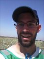
I'm here!

