Difference between revisions of "2017-07-21 50 8"
From Geohashing
imported>FippeBot m (Location) |
imported>Mampfred |
||
| Line 1: | Line 1: | ||
| − | |||
| − | |||
| − | |||
| − | |||
| − | |||
| − | |||
| − | |||
| − | |||
| − | |||
{{meetup graticule | {{meetup graticule | ||
| lat=50 | | lat=50 | ||
| Line 22: | Line 13: | ||
== Participants == | == Participants == | ||
| − | + | * [[User:Mampfred|Mampfred]] | |
| − | |||
== Plans == | == Plans == | ||
| − | + | Unknown | |
== Expedition == | == Expedition == | ||
| − | + | Well apparently I did an expedition back then - and forgot to document it. Pretty much two years later I have no idea how the expedition went apart form the fact that I seem to have reached the coordinates accorging to the screenshozs ;) | |
| − | |||
*Coordinates reached -- [[User:Mampfred|Mampfred]] ([[User talk:Mampfred|talk]]) 21:55, 21 July 2017 (GMT+02:00) | *Coordinates reached -- [[User:Mampfred|Mampfred]] ([[User talk:Mampfred|talk]]) 21:55, 21 July 2017 (GMT+02:00) | ||
| + | *Coordinates reached -- [[User:Mampfred|Mampfred]] ([[User talk:Mampfred|talk]]) [http://www.openstreetmap.org/?lat=50.13790980&lon=8.34583260&zoom=16&layers=B000FTF @50.1379,8.3458] 21:56, 21 July 2017 (GMT+02:00) | ||
| − | |||
== Tracklog == | == Tracklog == | ||
| − | + | Not available. | |
== Photos == | == Photos == | ||
| − | |||
| − | |||
| − | |||
<gallery perrow="5"> | <gallery perrow="5"> | ||
| − | |||
Image:2017-07-21_50_8_Mampfred_1500667038422.jpg|Yay | Image:2017-07-21_50_8_Mampfred_1500667038422.jpg|Yay | ||
| − | |||
Image:2017-07-21_50_8_Mampfred_1500667215577.jpg|Coordinates reached | Image:2017-07-21_50_8_Mampfred_1500667215577.jpg|Coordinates reached | ||
</gallery> | </gallery> | ||
| Line 52: | Line 36: | ||
{{#vardefine:ribbonwidth|800px}} | {{#vardefine:ribbonwidth|800px}} | ||
<!-- Add any achievement ribbons you earned below, or remove this section --> | <!-- Add any achievement ribbons you earned below, or remove this section --> | ||
| + | None | ||
[[Category:Expeditions]] | [[Category:Expeditions]] | ||
[[Category:Coordinates reached]] | [[Category:Coordinates reached]] | ||
{{location|DE|HE|MTK}} | {{location|DE|HE|MTK}} | ||
Latest revision as of 20:24, 28 July 2019
| Fri 21 Jul 2017 in 50,8: 50.1378969, 8.3458514 geohashing.info google osm bing/os kml crox |
Location
Participants
Plans
Unknown
Expedition
Well apparently I did an expedition back then - and forgot to document it. Pretty much two years later I have no idea how the expedition went apart form the fact that I seem to have reached the coordinates accorging to the screenshozs ;)
- Coordinates reached -- Mampfred (talk) 21:55, 21 July 2017 (GMT+02:00)
- Coordinates reached -- Mampfred (talk) @50.1379,8.3458 21:56, 21 July 2017 (GMT+02:00)
Tracklog
Not available.
Photos
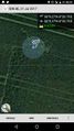
Yay

Coordinates reached


Achievements
None