Difference between revisions of "2017-11-10 47 -122"
From Geohashing
imported>Thomcat ([live picture]The hill [http://www.openstreetmap.org/?lat=47.70806870&lon=-122.32059940&zoom=16&layers=B000FTF @47.7081,-122.3206]) |
imported>Thomcat ([live picture]Spot [http://www.openstreetmap.org/?lat=47.69955150&lon=-122.32039530&zoom=16&layers=B000FTF @47.6996,-122.3204]) |
||
| Line 34: | Line 34: | ||
Image:2017-11-10_47_-122_thomcat_1510345665337.jpg|The hill [http://www.openstreetmap.org/?lat=47.70806870&lon=-122.32059940&zoom=16&layers=B000FTF @47.7081,-122.3206] | Image:2017-11-10_47_-122_thomcat_1510345665337.jpg|The hill [http://www.openstreetmap.org/?lat=47.70806870&lon=-122.32059940&zoom=16&layers=B000FTF @47.7081,-122.3206] | ||
| + | |||
| + | Image:2017-11-10_47_-122_thomcat_1510345909894.jpg|Spot [http://www.openstreetmap.org/?lat=47.69955150&lon=-122.32039530&zoom=16&layers=B000FTF @47.6996,-122.3204] | ||
</gallery> | </gallery> | ||
Revision as of 20:31, 10 November 2017
| Fri 10 Nov 2017 in Seattle: 47.6995713, -122.3203841 geohashing.info google osm bing/os kml crox |
Location
The intersection of 8th NE and NE 97th in the Maple Leaf neighborhood of Seattle.
Participants
Plans
Stop by at lunchtime, and possibly again if anyone else wants to join. There is a 7-11 five blocks away, at NE 92nd and Roosevelt.
- Might try to stop by too, but it's a bit of a trek from downtown. Fixed 92nd vs 97th above; Northgate Mall is also about five blocks away. Coyotebush (talk) 16:30, 10 November 2017 (UTC)
- If only that light rail station they are building at Northgate were done, it would be a short walk. Uphill, but a short walk. --Thomcat (talk) 19:11, 10 November 2017 (UTC)
Expedition
Tracklog
Photos
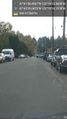
The hill @47.7081,-122.3206
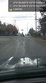
Spot @47.6996,-122.3204


Achievements