Difference between revisions of "2018-01-12 -35 149"
imported>Felix Dance ([live picture]Hash success! [http://www.openstreetmap.org/?lat=-35.28295190&lon=149.12459130&zoom=16&layers=B000FTF @-35.2830,149.1246]) |
imported>FippeBot m (Location) |
||
| (4 intermediate revisions by 2 users not shown) | |||
| Line 1: | Line 1: | ||
| − | |||
| − | |||
| − | |||
| − | |||
| − | |||
| − | |||
| − | |||
| − | |||
| − | |||
{{meetup graticule | {{meetup graticule | ||
| lat=-35 | | lat=-35 | ||
| Line 14: | Line 5: | ||
| date=2018-01-12 | | date=2018-01-12 | ||
}} | }} | ||
| − | |||
| − | |||
| − | |||
== Location == | == Location == | ||
| − | + | In the hills above Canberra, near Mt Stromlo | |
== Participants == | == Participants == | ||
| − | + | *[[User:Felix Dance|Felix Dance]] | |
| − | + | ||
| + | == Expedition == | ||
| + | I'd just moved to Canberra three days previously and was keen to do my first ACT geohash, particularly as I'd come here on a long cycle tour and only realised I'd missed an easy one right where I was staying due to ignorance a year ago. | ||
| + | |||
| + | Having spent most of the day faffing around not geohashing I finally got it together and left on my bike with two hours to go. | ||
| − | + | It was hot, and I had a headwind. A few hills and I was nearly there. Just before the turn off I came across a construction site for a new housing development that completely blocked off my access. I had to take the long way around the back. | |
| − | |||
| − | + | As I left the main road and got onto some bush tracks along the hillside the heat gave way to drops of rain. Thankfully, I got to the hash, negotiating the scrub and spiders, and was back out to the road without a downpour soaking my jean-shorts. | |
| − | |||
| + | I took the tailwind along a different route to head back, stopping only to pump up my flattening tyre. ACT geohash achieved. I only have Jervis Bay Territory left on the Australian Mainland to geohash now... | ||
*ACT success! -- [[User:Felix Dance|Felix Dance]] ([[User talk:Felix Dance|talk]]) [http://www.openstreetmap.org/?lat=-35.28229020&lon=149.12399910&zoom=16&layers=B000FTF @-35.2823,149.1240] 15:45, 12 January 2018 (GMT+11:00) | *ACT success! -- [[User:Felix Dance|Felix Dance]] ([[User talk:Felix Dance|talk]]) [http://www.openstreetmap.org/?lat=-35.28229020&lon=149.12399910&zoom=16&layers=B000FTF @-35.2823,149.1240] 15:45, 12 January 2018 (GMT+11:00) | ||
| − | == | + | |
| − | + | == Route == | |
| + | [https://goo.gl/maps/TXgp8wdqrwt Here] is a map of my route. | ||
== Photos == | == Photos == | ||
| Line 43: | Line 35: | ||
Image:2018-01-12_-35_149_Felix Dance_1515732407336.jpg|Hash success! [http://www.openstreetmap.org/?lat=-35.28295190&lon=149.12459130&zoom=16&layers=B000FTF @-35.2830,149.1246] | Image:2018-01-12_-35_149_Felix Dance_1515732407336.jpg|Hash success! [http://www.openstreetmap.org/?lat=-35.28295190&lon=149.12459130&zoom=16&layers=B000FTF @-35.2830,149.1246] | ||
| + | |||
| + | Image:2018-01-12_-35_149_Felix Dance_1515732453943.jpg|GPS proof [http://www.openstreetmap.org/?lat=-35.28298440&lon=149.12461400&zoom=16&layers=B000FTF @-35.2830,149.1246] | ||
| + | |||
| + | Image:2018-01-12_-35_149_Felix Dance_1515732481870.jpg|Hash surrounds - housing estate construction [http://www.openstreetmap.org/?lat=-35.28269350&lon=149.12443300&zoom=16&layers=B000FTF @-35.2827,149.1244] | ||
</gallery> | </gallery> | ||
== Achievements == | == Achievements == | ||
| − | {{ | + | {{bicycle geohash |
| − | |||
| − | + | | latitude = -35 | |
| − | + | | longitude = 149 | |
| − | [[ | + | | date = 2018-01-12 |
| + | | name = [[User:Felix Dance|Felix Dance]] | ||
| + | | distance = 33 kms | ||
| + | | bothways = true | ||
| + | | image = 2018-01-12_-35_149_Felix Dance_1515732407336.jpg | ||
| − | + | }} | |
| − | |||
| − | |||
| − | |||
| − | |||
| − | |||
| − | |||
| − | |||
| − | |||
[[Category:Expeditions]] | [[Category:Expeditions]] | ||
| − | |||
[[Category:Expeditions with photos]] | [[Category:Expeditions with photos]] | ||
| − | |||
| − | |||
| − | |||
| − | |||
| − | |||
[[Category:Coordinates reached]] | [[Category:Coordinates reached]] | ||
| − | + | {{location|AU|ACT}} | |
| − | |||
| − | |||
| − | |||
| − | |||
| − | |||
| − | |||
| − | |||
| − | |||
| − | |||
| − | |||
| − | |||
| − | |||
| − | |||
| − | |||
| − | |||
| − | |||
| − | |||
Latest revision as of 18:36, 26 July 2019
| Fri 12 Jan 2018 in -35,149: -35.2998154, 149.0187200 geohashing.info google osm bing/os kml crox |
Location
In the hills above Canberra, near Mt Stromlo
Participants
Expedition
I'd just moved to Canberra three days previously and was keen to do my first ACT geohash, particularly as I'd come here on a long cycle tour and only realised I'd missed an easy one right where I was staying due to ignorance a year ago.
Having spent most of the day faffing around not geohashing I finally got it together and left on my bike with two hours to go.
It was hot, and I had a headwind. A few hills and I was nearly there. Just before the turn off I came across a construction site for a new housing development that completely blocked off my access. I had to take the long way around the back.
As I left the main road and got onto some bush tracks along the hillside the heat gave way to drops of rain. Thankfully, I got to the hash, negotiating the scrub and spiders, and was back out to the road without a downpour soaking my jean-shorts.
I took the tailwind along a different route to head back, stopping only to pump up my flattening tyre. ACT geohash achieved. I only have Jervis Bay Territory left on the Australian Mainland to geohash now...
- ACT success! -- Felix Dance (talk) @-35.2823,149.1240 15:45, 12 January 2018 (GMT+11:00)
Route
Here is a map of my route.
Photos
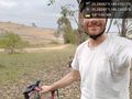
Hash success! @-35.2830,149.1246
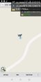
GPS proof @-35.2830,149.1246
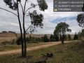
Hash surrounds - housing estate construction @-35.2827,149.1244


Achievements
Felix Dance earned the Bicycle geohash achievement
|