Difference between revisions of "2018-02-10 47 -122"
imported>Thomcat ([live picture]Big pond [http://www.openstreetmap.org/?lat=47.47793470&lon=-122.23326550&zoom=16&layers=B000FTF @47.4779,-122.2333]) |
imported>Thomcat ([live picture]More tents [http://www.openstreetmap.org/?lat=47.47785770&lon=-122.23321490&zoom=16&layers=B000FTF @47.4779,-122.2332]) |
||
| Line 44: | Line 44: | ||
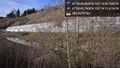
Image:2018-02-10_47_-122_thomcat_1518298625797.jpg|Big pond [http://www.openstreetmap.org/?lat=47.47793470&lon=-122.23326550&zoom=16&layers=B000FTF @47.4779,-122.2333] | Image:2018-02-10_47_-122_thomcat_1518298625797.jpg|Big pond [http://www.openstreetmap.org/?lat=47.47793470&lon=-122.23326550&zoom=16&layers=B000FTF @47.4779,-122.2333] | ||
| + | |||
| + | Image:2018-02-10_47_-122_thomcat_1518298705239.jpg|More tents [http://www.openstreetmap.org/?lat=47.47785770&lon=-122.23321490&zoom=16&layers=B000FTF @47.4779,-122.2332] | ||
</gallery> | </gallery> | ||
Revision as of 21:38, 10 February 2018

| Sat 10 Feb 2018 in Seattle: 47.4780175, -122.2321579 geohashing.info google osm bing/os kml crox |
Location
Near the banks of the former Black River in Renton.
Participants
Plans
Mid-day expedition and exploration through the Black River Riparian Forest.
Expedition
Once upon a time, the Black River flowed out of the south end of Lake Washington and joined up with the White River to form the Duwamish River. It was a beautiful, meandering river, though it occasionally flooded and flowed back into the lake. The people of Seattle wanted to build a Ship Canal and connect their big lake to the sound, and because of that, the Black River disappeared.
Today's geohashpoint is on a hillside, the bank of that long forgotten river, and quite near a park set up in its name. This is probably also worth of a Tale of Two Hashes challenge.
Tracklog
Photos
Trailhead @47.4766,-122.2341
Gap in fence @47.4785,-122.2351
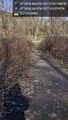
Encampment @47.4787,-122.2348
Grate @47.4793,-122.2368
Graffiti wall @47.4794,-122.2368
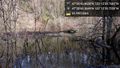
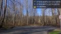
Big pond @47.4779,-122.2333
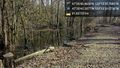
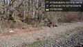
More tents @47.4779,-122.2332


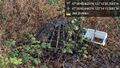
Achievements