Difference between revisions of "2018-04-05 50 8"
imported>DODO (→Location) |
imported>FippeBot m (Location) |
||
| (6 intermediate revisions by one other user not shown) | |||
| Line 25: | Line 25: | ||
<!-- who attended: If you link to your wiki user name in this section, your expedition will be picked up by the various statistics generated for geohashing. You may use three tildes ~ as a shortcut to automatically insert the user signature of the account you are editing with. | <!-- who attended: If you link to your wiki user name in this section, your expedition will be picked up by the various statistics generated for geohashing. You may use three tildes ~ as a shortcut to automatically insert the user signature of the account you are editing with. | ||
--> | --> | ||
| + | [[User:DODO|DODO]] | ||
== Plans == | == Plans == | ||
<!-- what were the original plans --> | <!-- what were the original plans --> | ||
| + | Although the closest Hash to my hotel is in the Bonn graticule near the Mosel, the rules state, that I have to go to the nearest hash to yesterdays hashpoint and that is in the Frankfurt graticule near the Rhine. The problem is that I have to go there by train and there is a station just 500 m from the hashponit, and there is a direct train from Koblenz (6 KM from the hotel) to that station. So it is much to easy to get there Because of that I decided to try a double hash. The natural candidate would have been the one in the Bonn graticule in the west, but I had to ride all the way back to Koblenz to get there, and so I aimed for the [[2018-04-05_50_9|Fulda one]] to the east. | ||
== Expedition == | == Expedition == | ||
| Line 34: | Line 36: | ||
*To easy -- [[User:DODO|DODO]] ([[User talk:DODO|talk]]) 13:34, 8 April 2018 (GMT+02:00) | *To easy -- [[User:DODO|DODO]] ([[User talk:DODO|talk]]) 13:34, 8 April 2018 (GMT+02:00) | ||
| + | The rest will follow. | ||
| + | |||
== Tracklog == | == Tracklog == | ||
<!-- if your GPS device keeps a log, you may post a link here --> | <!-- if your GPS device keeps a log, you may post a link here --> | ||
| + | [https://www.komoot.de/tour/28805856 6,5 KM walking to Koblenz main station], [https://www.komoot.de/tour/28809342 86 KM by train] and another [https://www.komoot.de/tour/28811972 4 KM from Uhlerborn to Heidesheim] | ||
== Photos == | == Photos == | ||
| Line 42: | Line 47: | ||
--> | --> | ||
<gallery perrow="5"> | <gallery perrow="5"> | ||
| + | Image:2018-04-05 50 8-proof.jpg|proof | ||
</gallery> | </gallery> | ||
| + | More will follow. | ||
== Achievements == | == Achievements == | ||
{{#vardefine:ribbonwidth|800px}} | {{#vardefine:ribbonwidth|800px}} | ||
<!-- Add any achievement ribbons you earned below, or remove this section --> | <!-- Add any achievement ribbons you earned below, or remove this section --> | ||
| + | {{land geohash | ||
| + | | latitude = 50 | ||
| + | | longitude =8 | ||
| + | | date = 2018-04-05 | ||
| + | | name = DODO | ||
| + | }} | ||
| − | + | {{Public transport geohash | |
| − | + | | latitude = 50 | |
| − | + | | longitude = 8 | |
| + | | date = 2018-04-05 | ||
| + | | name = DODO | ||
| + | }} | ||
| − | + | {{consecutive geohash | |
| + | | count = 4 | ||
| + | | latitude = 49 | ||
| + | | longitude = 8 | ||
| + | | date = 2018-04-02 | ||
| + | | name = DODO | ||
| + | }} | ||
| − | |||
| − | |||
| − | |||
| − | |||
| − | |||
| − | |||
| − | |||
| − | |||
[[Category:Expeditions]] | [[Category:Expeditions]] | ||
| − | |||
| − | |||
| − | |||
| − | |||
| − | |||
| − | |||
| − | |||
[[Category:Coordinates reached]] | [[Category:Coordinates reached]] | ||
| − | + | {{location|DE|RP|MZ}} | |
| − | |||
| − | |||
| − | |||
| − | |||
| − | |||
| − | |||
| − | |||
| − | |||
| − | |||
| − | |||
| − | |||
| − | |||
| − | |||
| − | |||
| − | |||
| − | |||
| − | |||
Latest revision as of 03:27, 16 August 2019
| Thu 5 Apr 2018 in 50,8: 50.0068180, 8.1392316 geohashing.info google osm bing/os kml crox |
Location
In the residential area Uhlerborn between Ingelheim and Mainz.
Participants
Plans
Although the closest Hash to my hotel is in the Bonn graticule near the Mosel, the rules state, that I have to go to the nearest hash to yesterdays hashpoint and that is in the Frankfurt graticule near the Rhine. The problem is that I have to go there by train and there is a station just 500 m from the hashponit, and there is a direct train from Koblenz (6 KM from the hotel) to that station. So it is much to easy to get there Because of that I decided to try a double hash. The natural candidate would have been the one in the Bonn graticule in the west, but I had to ride all the way back to Koblenz to get there, and so I aimed for the Fulda one to the east.
Expedition
The rest will follow.
Tracklog
6,5 KM walking to Koblenz main station, 86 KM by train and another 4 KM from Uhlerborn to Heidesheim
Photos
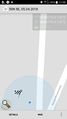
proof

More will follow.
Achievements
DODO earned the Land geohash achievement
|
DODO earned the Public transport geohash achievement
|
DODO earned the Consecutive geohash achievement
|