Difference between revisions of "2018-04-07 49 8"
From Geohashing
imported>DODO (→Plans) |
imported>FippeBot m (Location) |
||
| (3 intermediate revisions by one other user not shown) | |||
| Line 33: | Line 33: | ||
== Expedition == | == Expedition == | ||
<!-- how it all turned out. your narrative goes here. --> | <!-- how it all turned out. your narrative goes here. --> | ||
| + | Will follow | ||
== Tracklog == | == Tracklog == | ||
<!-- if your GPS device keeps a log, you may post a link here --> | <!-- if your GPS device keeps a log, you may post a link here --> | ||
| + | Well, much to much train-riding to be tracked, but a [https://www.komoot.de/tour/28932683 10 KM walk] from Gräveneck to Weilburg and another [https://www.komoot.de/tour/28977619 almost 10 KM walk] to the hash. | ||
== Photos == | == Photos == | ||
| Line 50: | Line 52: | ||
{{#vardefine:ribbonwidth|800px}} | {{#vardefine:ribbonwidth|800px}} | ||
<!-- Add any achievement ribbons you earned below, or remove this section --> | <!-- Add any achievement ribbons you earned below, or remove this section --> | ||
| + | {{land geohash | ||
| + | | latitude = 49 | ||
| + | | longitude =8 | ||
| + | | date = 2018-04-07 | ||
| + | | name = DODO | ||
| + | }} | ||
| − | + | {{Public transport geohash | |
| − | + | | latitude = 49 | |
| − | + | | longitude = 8 | |
| + | | date = 2018-04-07 | ||
| + | | name = DODO | ||
| + | }} | ||
| − | + | {{consecutive geohash | |
| + | | count = 6 | ||
| + | | latitude = 49 | ||
| + | | longitude = 8 | ||
| + | | date = 2018-04-02 | ||
| + | | name = DODO | ||
| + | }} | ||
| − | + | I came very close to this hash on my walk to [[2016-03-29_49_8]] but I decided to stay at the river, so I missed it by around 200 m as you can see on the tracklog. | |
| − | |||
| − | [[ | ||
| − | |||
| − | |||
| − | |||
| − | |||
[[Category:Expeditions]] | [[Category:Expeditions]] | ||
| − | |||
| − | |||
| − | |||
| − | |||
| − | |||
| − | |||
| − | |||
[[Category:Coordinates reached]] | [[Category:Coordinates reached]] | ||
| − | + | {{location|DE|HE|GG}} | |
| − | |||
| − | |||
| − | |||
| − | |||
| − | |||
| − | |||
| − | |||
| − | |||
| − | |||
| − | |||
| − | |||
| − | |||
| − | |||
| − | |||
| − | |||
| − | |||
| − | |||
Latest revision as of 03:28, 16 August 2019
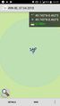
| Sat 7 Apr 2018 in 49,8: 49.7427753, 8.4631469 geohashing.info google osm bing/os kml crox |
Location
In the lowland forest near Gernsheim.
Participants
Plans
Well, I had to get home today and this hashpoint was the only one close enough to my track. So I decided to leave the train in Gernsheim, walk to the hash and continue to the station in Groß-Rohrheim to continue my ride home.
Expedition
Will follow
Tracklog
Well, much to much train-riding to be tracked, but a 10 KM walk from Gräveneck to Weilburg and another almost 10 KM walk to the hash.
Photos

Happy hasher
proof


Achievements
DODO earned the Land geohash achievement
|
DODO earned the Public transport geohash achievement
|
DODO earned the Consecutive geohash achievement
|
I came very close to this hash on my walk to 2016-03-29_49_8 but I decided to stay at the river, so I missed it by around 200 m as you can see on the tracklog.