Difference between revisions of "2018-08-21 31 34"
From Geohashing
imported>Fippe (Location) |
(→Photos) |
||
| (One intermediate revision by one other user not shown) | |||
| Line 43: | Line 43: | ||
--> | --> | ||
<gallery perrow="5"> | <gallery perrow="5"> | ||
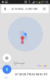
| + | Image:Screenshot 2018-08-21-07-35-25.png | proof | ||
</gallery> | </gallery> | ||
| Line 49: | Line 50: | ||
<!-- Add any achievement ribbons you earned below, or remove this section --> | <!-- Add any achievement ribbons you earned below, or remove this section --> | ||
| − | |||
| − | |||
| − | |||
| − | |||
| − | |||
| − | |||
| − | |||
| − | |||
| − | |||
| − | |||
| − | |||
| − | |||
| − | |||
| − | |||
[[Category:Expeditions]] | [[Category:Expeditions]] | ||
| − | |||
| − | |||
| − | |||
| − | |||
| − | |||
| − | |||
| − | |||
[[Category:Coordinates reached]] | [[Category:Coordinates reached]] | ||
| − | |||
| − | |||
| − | |||
| − | |||
| − | |||
| − | |||
| − | |||
| − | |||
| − | |||
| − | |||
| − | |||
| − | |||
| − | |||
| − | |||
| − | |||
| − | |||
| − | |||
| − | |||
{{location|IL|D|AS}} | {{location|IL|D|AS}} | ||
Latest revision as of 22:26, 23 April 2020
| Tue 21 Aug 2018 in 31,34: 31.5931158, 34.7616257 geohashing.info google osm bing/os kml crox |
Location
'Uza: possibly in someone's house or barn.
Participants
Plans
Drive to Kiryat Gat and park as close as possible to highway 35. Run to the hashpoint.
Expedition
I parked on Shivtei Yisrael in Kiryat Gat and ran southeast. I thought I would be able to use a trail that passed under the railroad but it was blocked. I continued running west to highway 40 and then took an agricultural trail parallel to the highway into 'Uza. From there I ran down main street and entered into a complex of small houses right on the edge of the fields. Nobody was awake, the gate was open and I acted as if I was looking for a friend to visit. By the time I almost got to one of the house's front door, I was already at the hashpoint. No pictures, let's go.
Tracklog
Photos
proof
