Difference between revisions of "2018-12-30 43 3"
imported>Fractal |
imported>Fractal |
||
| Line 23: | Line 23: | ||
Image:2012-##-## ## ## Alpha.jpg | Witty Comment | Image:2012-##-## ## ## Alpha.jpg | Witty Comment | ||
--> | --> | ||
| − | <gallery perrow=" | + | <gallery perrow="4" widths=200px heights=200px> |
| + | Image:2018-12-30_43_3-6.jpg | The hashpoint is in this direction | ||
| + | Image:2018-12-30_43_3-7.jpg | The landscape around us | ||
| + | Image:2018-12-30_43_3-1.jpg | Some small cliffs that we had to go through | ||
| + | Image:2018-12-30_43_3-8.png | We made it! | ||
| + | Image:2018-12-30_43_3-4.jpg | All of us | ||
| + | Image:2018-12-30_43_3-3.jpg | Anna and I | ||
| + | Image:2018-12-30_43_3-2.jpg | We made a very temporary sign at the hashpoint | ||
| + | Image:2018-12-30_43_3-5.jpg | The way back | ||
</gallery> | </gallery> | ||
Revision as of 17:37, 30 December 2018
| Sun 30 Dec 2018 in 43,3: 43.9933206, 3.3097163 geohashing.info google osm bing/os kml crox |
Location
In a forest close to the road going north to Nant.
Participants
Expedition
The hashpoint was very close to a road that we were planning to take anyway, and there was a very convenient place to stop right there. At first it seemed quite difficult to reach the hashpoint, despite it being only 150m from the place we stopped, as we had to climb a small cliff and there was a lot of thorny plants. But we managed to go to a place where the climbing was easier, and after a difficult beginning it was quite easy to continue. We took some pictures there, and then we went back a different way. It turned out there was a nice path on the other side, so we could have avoided the climbing and the thorny bushes.
Photos
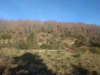
The hashpoint is in this direction
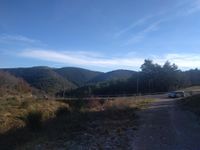
The landscape around us
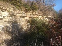
Some small cliffs that we had to go through
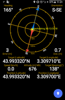
We made it!
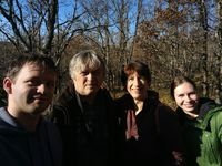
All of us
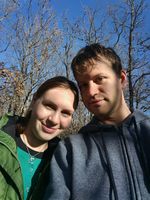
Anna and I
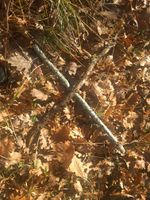
We made a very temporary sign at the hashpoint
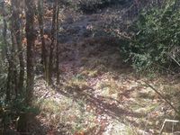
The way back


