Difference between revisions of "2019-02-16 57 12"
imported>FelixTheCat |
imported>FippeBot m (Location) |
||
| Line 31: | Line 31: | ||
[[Category:Expeditions with photos]] | [[Category:Expeditions with photos]] | ||
[[Category:Coordinates reached]] | [[Category:Coordinates reached]] | ||
| + | {{location|SE|O}} | ||
Latest revision as of 03:32, 7 August 2019
| Sat 16 Feb 2019 in 57,12: 57.3883921, 12.4185840 geohashing.info google osm bing/os kml crox |
Location
Högenhult, Marks municipality, Västra Götaland county, Sweden.
Participants
Expedition
I was travelling in Sweden, today going from Trollhättan to Varberg, and I decided to visit this hash that was in a forest about 45 minutes north of Varberg. I parked the rental hashmobile at a small car park at the beginning of a forest road, figuring that its rudimentary pavement would not be very kind to tyres and paint. This did mean that I would have to walk about 1.5 km to reach the hash. But the weather was nice, so it was quite a pleasant walk. I had to walk about 100 metres off the road to reach the hash, but I finally found it pretty easily. I took some pictures and went back to the car, continuing my way to Varberg and the Grimeton Radio Station.
Photos
Parked the car right here, just off the main road.
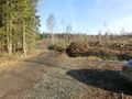
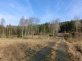
The road leading into the forest.
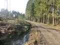
Turning right onto Lösjövägen.
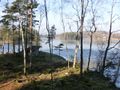
Passing a lake with a cute little cabin overlooking it.
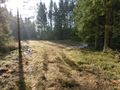
The hash is up ahead on the left.
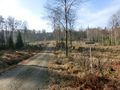
Straight ahead from here.
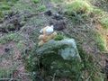
Lloyd posing on the hash rock.
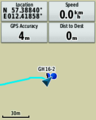
GPS proof.
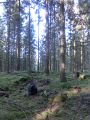
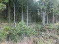
The surroundings. It looks pretty similar on all sides.
Walking back to the car.


