Difference between revisions of "2019-03-21 51 7"
From Geohashing
imported>GeorgDerReisende (expedition report for Hamm) |
imported>GeorgDerReisende (achievement added) |
||
| Line 39: | Line 39: | ||
2019-03-21 51 7 GeorgDerReisende 1098.jpg | the geohasher | 2019-03-21 51 7 GeorgDerReisende 1098.jpg | the geohasher | ||
</gallery> | </gallery> | ||
| + | |||
| + | == Achievements == | ||
| + | |||
| + | {{OpenStreetMap achievement | latitude = 51 | longitude = 7 | date = 2019-03-21 | OSMlink = 68457057 }} | ||
[[Category:Expeditions]] | [[Category:Expeditions]] | ||
Latest revision as of 22:22, 24 March 2019
| Thu 21 Mar 2019 in 51,7: 51.6416366, 7.7405830 geohashing.info google osm bing/os kml crox |
Location
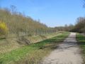
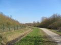
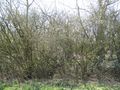
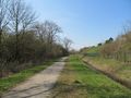
The hash lay on the southern side of the Halde Sundern in Hamm.
Participants
Plans
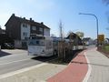
A tram, two trains and two buses and some walk.
Expedition
I left home at 7 o'clock. With two trains I arrived at Hamm. Then I took a bus to the direction southwest. Suddenly I heard a scraaaatchch. And the bus couldn't go further. I had to wait for 30 minutes for the next bus. At least I walked to the hash. But there was a ditch around the Halde. But the hash lay between the footpath and the ditch.
Photos

a little accident
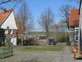
arrived
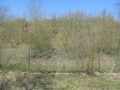
first view to the hash
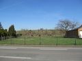
second view to the hash
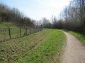
around this way, somewhere
in the shadow of the tree
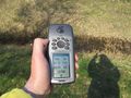
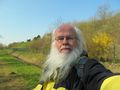
proof
looking north
east
south
west
the geohasher


Achievements
This user earned the OpenStreetMap achievement
|