Difference between revisions of "2019-03-22 51 9"
From Geohashing
imported>GeorgDerReisende (new report) |
imported>GeorgDerReisende (+ cat) |
||
| (One intermediate revision by the same user not shown) | |||
| Line 1: | Line 1: | ||
| + | [[Image:{{{image|2019-03-22 51 9 GeorgDerReisende 0001.jpg}}}|thumb|left]] | ||
| − | |||
| − | |||
| − | |||
| − | |||
| − | |||
| − | |||
| − | |||
| − | |||
| − | |||
{{meetup graticule | {{meetup graticule | ||
| lat=51 | | lat=51 | ||
| Line 19: | Line 11: | ||
== Location == | == Location == | ||
| − | + | ||
| + | On the state road 580 from Einbeck to Dassel. | ||
== Participants == | == Participants == | ||
| − | + | ||
| − | + | [[User:GeorgDerReisende|GeorgDerReisende]] | |
== Plans == | == Plans == | ||
| − | + | ||
| + | My Garmin is out of order. So I had to plan the expedition carefully. The map showed me the hash between the fifth and the sixth dashed line east of a junction of the state road with the field way. | ||
== Expedition == | == Expedition == | ||
| − | |||
| − | + | I traveled by public transport to Einbeck-Holtensen and walked about 1.5 kilometers through the fields to the hash. Becaus I knew the exact location there was no need for a dance and it would have been very dangerous. | |
| − | |||
== Photos == | == Photos == | ||
| − | |||
| − | |||
| − | |||
<gallery perrow="5"> | <gallery perrow="5"> | ||
| + | 2019-03-22 51 9 GeorgDerReisende 1446.jpg | arrived | ||
| + | 2019-03-22 51 9 GeorgDerReisende 1463.jpg | 625 m to hash | ||
| + | 2019-03-22 51 9 GeorgDerReisende 1464.jpg | | ||
| + | 2019-03-22 51 9 GeorgDerReisende 1465.jpg | a nice bridge across the river | ||
| + | 2019-03-22 51 9 GeorgDerReisende 1470.jpg | 370 m to hash | ||
| + | 2019-03-22 51 9 GeorgDerReisende 1475.jpg | 100 m to hash | ||
| + | 2019-03-22 51 9 GeorgDerReisende 1478.jpg | five dashed lines to hash | ||
| + | 2019-03-22 51 9 GeorgDerReisende 1479.jpg | the hash is here between both the two dashed lines | ||
| + | 2019-03-22 51 9 GeorgDerReisende 1480.jpg | detail | ||
| + | 2019-03-22 51 9 GeorgDerReisende 1481.jpg | the other side | ||
| + | 2019-03-22 51 9 GeorgDerReisende 1482.jpg | looking west | ||
| + | 2019-03-22 51 9 GeorgDerReisende 1485.jpg | looking north | ||
| + | 2019-03-22 51 9 GeorgDerReisende 1484.jpg | looking east | ||
| + | 2019-03-22 51 9 GeorgDerReisende 1486.jpg | looking south | ||
| + | 2019-03-22 51 9 GeorgDerReisende 1487.jpg | the geohasher | ||
</gallery> | </gallery> | ||
| − | + | [[Category:Expeditions]] | |
| − | |||
| − | |||
| − | + | [[Category:Expeditions with photos]] | |
| − | |||
| − | [[Category: | ||
| − | + | {{location|DE|NI|NOM}} | |
| − | + | [[Category:Expedition without GPS]] | |
| − | |||
| − | [[Category:Expedition | ||
| − | |||
| − | |||
| − | |||
| − | |||
| − | |||
| − | |||
| − | |||
| − | |||
| − | |||
| − | |||
| − | |||
| − | |||
| − | |||
| − | |||
[[Category:Coordinates reached]] | [[Category:Coordinates reached]] | ||
| − | |||
| − | |||
| − | |||
| − | |||
| − | |||
| − | |||
| − | |||
| − | |||
| − | |||
| − | |||
| − | |||
| − | |||
| − | |||
| − | |||
| − | |||
| − | |||
| − | |||
| − | |||
Latest revision as of 05:05, 25 March 2019

| Fri 22 Mar 2019 in 51,9: 51.8203586, 9.8023541 geohashing.info google osm bing/os kml crox |
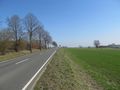
Location
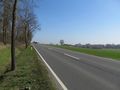
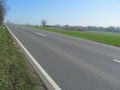
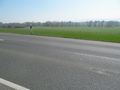
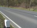
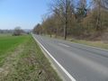
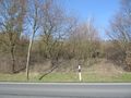
On the state road 580 from Einbeck to Dassel.
Participants
Plans
My Garmin is out of order. So I had to plan the expedition carefully. The map showed me the hash between the fifth and the sixth dashed line east of a junction of the state road with the field way.
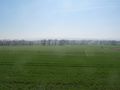
Expedition
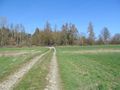
I traveled by public transport to Einbeck-Holtensen and walked about 1.5 kilometers through the fields to the hash. Becaus I knew the exact location there was no need for a dance and it would have been very dangerous.
Photos
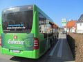
arrived
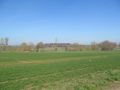
625 m to hash
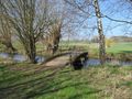
a nice bridge across the river
370 m to hash
100 m to hash
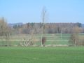
five dashed lines to hash
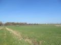
the hash is here between both the two dashed lines
detail
the other side
looking west
looking north
looking east
looking south
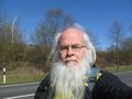
the geohasher


