Difference between revisions of "2019-06-02 39 -77"
From Geohashing
imported>OfficeLinebacker ([live picture]Success! [http://www.openstreetmap.org/?lat=39.10100240&lon=-77.24550520&zoom=16&layers=B000FTF @39.1010,-77.2455]) |
imported>Fippe (coordinates reached) |
||
| (3 intermediate revisions by 2 users not shown) | |||
| Line 20: | Line 20: | ||
== Location == | == Location == | ||
<!-- where you've surveyed the hash to be --> | <!-- where you've surveyed the hash to be --> | ||
| + | This geohash is located in a forest in [[wikipedia:North Potomac|North Potomac]]. | ||
== Participants == | == Participants == | ||
<!-- who attended: If you link to your wiki user name in this section, your expedition will be picked up by the various statistics generated for geohashing. You may use three tildes ~ as a shortcut to automatically insert the user signature of the account you are editing with. | <!-- who attended: If you link to your wiki user name in this section, your expedition will be picked up by the various statistics generated for geohashing. You may use three tildes ~ as a shortcut to automatically insert the user signature of the account you are editing with. | ||
--> | --> | ||
| + | *[[User:OfficeLinebacker|OfficeLinebacker]] | ||
== Plans == | == Plans == | ||
| Line 33: | Line 35: | ||
*About to attempt -- [[User:OfficeLinebacker|OfficeLinebacker]] ([[User talk:OfficeLinebacker|talk]]) [http://www.openstreetmap.org/?lat=39.09319310&lon=-77.15534600&zoom=16&layers=B000FTF @39.0932,-77.1553] 10:43, 2 June 2019 (EDT) | *About to attempt -- [[User:OfficeLinebacker|OfficeLinebacker]] ([[User talk:OfficeLinebacker|talk]]) [http://www.openstreetmap.org/?lat=39.09319310&lon=-77.15534600&zoom=16&layers=B000FTF @39.0932,-77.1553] 10:43, 2 June 2019 (EDT) | ||
| + | *The pictures show that OfficeLinebacker reached the coordinates. | ||
| + | |||
== Tracklog == | == Tracklog == | ||
<!-- if your GPS device keeps a log, you may post a link here --> | <!-- if your GPS device keeps a log, you may post a link here --> | ||
| Line 43: | Line 47: | ||
Image:2019-06-02_39_-77_OfficeLinebacker_1559490396134.jpg|Success! [http://www.openstreetmap.org/?lat=39.10100240&lon=-77.24550520&zoom=16&layers=B000FTF @39.1010,-77.2455] | Image:2019-06-02_39_-77_OfficeLinebacker_1559490396134.jpg|Success! [http://www.openstreetmap.org/?lat=39.10100240&lon=-77.24550520&zoom=16&layers=B000FTF @39.1010,-77.2455] | ||
| + | |||
| + | Image:2019-06-02_39_-77_OfficeLinebacker_1559490513971.jpg|Better distance [http://www.openstreetmap.org/?lat=39.10092510&lon=-77.24591690&zoom=16&layers=B000FTF @39.1009,-77.2459] | ||
| + | |||
| + | Image:2019-06-02_39_-77_OfficeLinebacker_1559490832919.jpg|Trail sign | ||
</gallery> | </gallery> | ||
| Line 49: | Line 57: | ||
<!-- Add any achievement ribbons you earned below, or remove this section --> | <!-- Add any achievement ribbons you earned below, or remove this section --> | ||
| − | |||
| − | |||
| − | |||
| − | |||
| − | |||
| − | |||
| − | |||
| − | |||
| − | |||
| − | |||
| − | |||
| − | |||
| − | |||
| − | |||
[[Category:Expeditions]] | [[Category:Expeditions]] | ||
| − | |||
[[Category:Expeditions with photos]] | [[Category:Expeditions with photos]] | ||
| − | + | {{location|US|MD|MO}} | |
| − | |||
| − | |||
| − | {{location}} | ||
| − | |||
| − | |||
| − | |||
[[Category:Coordinates reached]] | [[Category:Coordinates reached]] | ||
| − | |||
| − | |||
| − | |||
| − | |||
| − | |||
| − | |||
| − | |||
| − | |||
| − | |||
| − | |||
| − | |||
| − | |||
| − | |||
| − | |||
| − | |||
| − | |||
| − | |||
| − | |||
Latest revision as of 12:23, 29 July 2019
| Sun 2 Jun 2019 in 39,-77: 39.1008752, -77.2458726 geohashing.info google osm bing/os kml crox |
Location
This geohash is located in a forest in North Potomac.
Participants
Plans
Expedition
- About to attempt -- OfficeLinebacker (talk) @39.0932,-77.1553 10:43, 2 June 2019 (EDT)
- The pictures show that OfficeLinebacker reached the coordinates.
Tracklog
Photos

Success! @39.1010,-77.2455

Better distance @39.1009,-77.2459
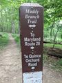
Trail sign


