Difference between revisions of "2019-07-17 51 13"
(+tracklog) |
(→Expedition) |
||
| Line 27: | Line 27: | ||
| − | + | {{tracklog | 2019-07-17 51 13-triton.gpx}} | |
[[Category:Expeditions]] | [[Category:Expeditions]] | ||
Latest revision as of 11:17, 17 August 2023
| Wed 17 Jul 2019 in Dresden: 51.0882427, 13.7119193 geohashing.info google osm bing/os kml crox |
Location
Today's location is in the backyard of a building in Dresden-Trachau.
Country: Germany; state: Sachsen (Saxony, EU:DE:SN); district: Dresden; Stadtbezirk: Pieschen; Stadtteil: Trachau
Expedition
Danatar
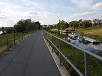
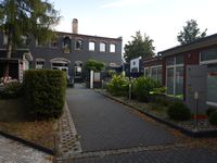
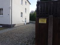
This was not far so I decided to try to get there. After work I cycled along the Elbe until I was at Pieschen, many people were outside walking or cycling. After a short trip through Pieschen I soon found the small street that crossed the railroad and one corner later I was near the hashpoint. At first I entered the yard of the "Center of holistic pain medicine". There I found a building that shouldn't be in that place, noticing people sitting on the ground in the entrance room. I quickly retreated before I could catch something holistic. Standing outside and trying to make sense of the unexpected building I noticed that I had mixed up the yards on the satellite image, the one with the hashpoint was one over. But there was a "private property" sign and I also saw somebody in the backyard. I then cycled home along mostly the same route.
|


