Difference between revisions of "2020-04-28 49 8"
(→Photos) |
(→Achievements) |
||
| Line 58: | Line 58: | ||
<!-- Add any achievement ribbons you earned below, or remove this section --> | <!-- Add any achievement ribbons you earned below, or remove this section --> | ||
| − | + | {{land geohash | |
| − | + | | latitude = 49 | |
| − | + | | longitude = 8 | |
| + | | date = 2020-04-28 | ||
| + | | name = DODO | ||
| + | }} | ||
| − | |||
| − | |||
| − | |||
| − | |||
| − | |||
| − | |||
| − | |||
| − | |||
| − | |||
| − | |||
[[Category:Expeditions]] | [[Category:Expeditions]] | ||
| − | |||
| − | |||
| − | |||
| − | |||
| − | |||
| − | |||
| − | |||
[[Category:Coordinates reached]] | [[Category:Coordinates reached]] | ||
| − | + | {{location|DE|RP|RP}} | |
| − | |||
| − | |||
| − | |||
| − | |||
| − | |||
| − | |||
| − | |||
| − | |||
| − | |||
| − | |||
| − | |||
| − | |||
| − | |||
| − | |||
| − | |||
| − | |||
| − | |||
Revision as of 15:43, 28 April 2020
| Tue 28 Apr 2020 in 49,8: 49.2673560, 8.5753898 geohashing.info google osm bing/os kml crox |
Location
In a forest near St. Leon
Participants
Plans
Go there by bull in the early morning.
Expedition
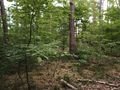
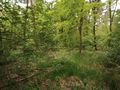
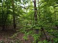
I'm working from home since six weeks and I miss my bull-riding to the office. When I saw the hashpoint yesterday, I decided to go there before work in the morning. I started a little later than usual at 8 o'clock. The weather wasn't that sunny and clear as in the last days, and in Altlußheim some drops of water started to fall. But the fun, to ride the bull again with an average speed of more than 30 KM/h outweighted that by far. After half an hour I was near my aim. I settled the bull 200 m from the hash. From here I had to walk into the forest. There was a sort of path leading into it and so it was easy to walk.
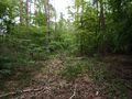
My "path" missed the hash by 40 m so I had to go orthogonal to it. To my surprise there were some more lanes parallel to the one I came. On the second of it, I reached the hash. I took some photos, built a mark (kind of) and walked back to my bull, using the new found lane.
On my way back, again in Altlußheim, the rainfall got stronger again and reached a light drizzle, still nothing to moan about. In Speyer I bought some asparagus and arrived back home at 9:15.
Tracklog
Photos
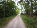
The path, where I lef tmy bull
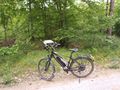
My bull, proof of transport
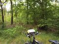
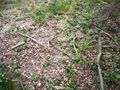
200 m in there

proof
west
north
east (my way back)
south

hasher
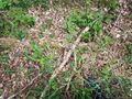
found this at the hash. Was anyone here before?
build my own mark


Achievements
DODO earned the Land geohash achievement
|