Difference between revisions of "2020-05-31 59 18"
(Replaced content with "{{subst:User:Fractal/Expedition}}") (Tag: Replaced) |
(report on expedition) |
||
| Line 1: | Line 1: | ||
| − | |||
{{meetup graticule | {{meetup graticule | ||
| lat={{#explode:{{SUBPAGENAME}}| |1}} | | lat={{#explode:{{SUBPAGENAME}}| |1}} | ||
| Line 7: | Line 6: | ||
== Location == | == Location == | ||
| − | + | In a park in Kärrtorp (south of Stockholm). | |
== Participants == | == Participants == | ||
| Line 13: | Line 12: | ||
== Plans == | == Plans == | ||
| − | + | I will be there at about 1pm/1:30pm. | |
== Expedition == | == Expedition == | ||
| − | + | This was a rather long expedition. The hashpoint was about 10 kilometers away from my place, and even though there is public transportation in Stockholm, the official advice is to not take it unless it is absolutely necessary (because of the pandemic). I don’t have a bike or a car either, so the only way for me to get there was on foot. At least the hashpoint seemed quite accessible, in the middle of a few trees in a park. | |
| + | |||
| + | It was a quite warm and sunny Sunday, so for the first time this year I went out wearing only sandals/shorts/T-shirt, and got sunscreen at the store as well. While planning the route I would take, I discovered the website/app mapy.cz, which allows you to choose between the shortest route between two points, or the "tourist" route, which tries to follow hiking paths or similar. The path it made me take through Södermalm turned out to be very interesting, much more than if I had simply chosen the shortest route. | ||
| + | |||
| + | The hashpoint was somewhat hidden between bushes and trees, but accessible nonetheless. After taking the required pictures, I had lunch with a friend at a nearby restaurant and then went back home taking a slightly different route, including a very short ferry ride in Hammarby Sjöstad. | ||
| + | |||
| + | In total it was an 8-hour expedition (left home at 11am, had lunch at 2pm, was back at 7pm), for about 25 kilometers of walking. | ||
== Photos == | == Photos == | ||
<gallery widths=200px heights=250px> | <gallery widths=200px heights=250px> | ||
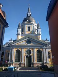
| − | Image: | + | Image:2020-05-31_59_18-1.jpg | Some church in the distance |
| + | Image:2020-05-31_59_18-2.jpg | The royal palace | ||
| + | Image:2020-05-31_59_18-3.jpg | A cozy park | ||
| + | Image:2020-05-31_59_18-4.jpg | Another interesting park with a circular building around it | ||
| + | Image:2020-05-31_59_18-5.jpg | A bascule bridge, south of Södermalm | ||
| + | Image:2020-05-31_59_18-6.jpg | Quite interesting modern architecture | ||
| + | Image:2020-05-31_59_18-7.jpg | The park in Kärrtorp | ||
| + | Image:2020-05-31_59_18-8.jpg | The hashpoint is there | ||
| + | Image:2020-05-31_59_18-9.jpg | Me at the hashpoint | ||
| + | Image:2020-05-31_59_18-13.png | Proof | ||
| + | Image:2020-05-31_59_18-10.jpg | Some hidden wooden stairs in Södermalm | ||
| + | Image:2020-05-31_59_18-11.jpg | Another church | ||
| + | Image:2020-05-31_59_18-12.jpg | A huge wall painting | ||
</gallery> | </gallery> | ||
| − | + | [[Category:Expeditions]] | |
| − | + | [[Category:Expeditions with photos]] | |
| − | |||
| − | |||
| − | |||
| − | |||
| − | |||
| − | |||
| − | |||
| − | + | [[Category:Coordinates reached]] | |
| − | |||
| − | |||
| − | |||
| − | |||
| − | |||
| − | |||
Revision as of 12:17, 21 June 2020
| Sun 31 May 2020 in 59,18: 59.2861452, 18.1147610 geohashing.info google osm bing/os kml crox |
Contents
Location
In a park in Kärrtorp (south of Stockholm).
Participants
Plans
I will be there at about 1pm/1:30pm.
Expedition
This was a rather long expedition. The hashpoint was about 10 kilometers away from my place, and even though there is public transportation in Stockholm, the official advice is to not take it unless it is absolutely necessary (because of the pandemic). I don’t have a bike or a car either, so the only way for me to get there was on foot. At least the hashpoint seemed quite accessible, in the middle of a few trees in a park.
It was a quite warm and sunny Sunday, so for the first time this year I went out wearing only sandals/shorts/T-shirt, and got sunscreen at the store as well. While planning the route I would take, I discovered the website/app mapy.cz, which allows you to choose between the shortest route between two points, or the "tourist" route, which tries to follow hiking paths or similar. The path it made me take through Södermalm turned out to be very interesting, much more than if I had simply chosen the shortest route.
The hashpoint was somewhat hidden between bushes and trees, but accessible nonetheless. After taking the required pictures, I had lunch with a friend at a nearby restaurant and then went back home taking a slightly different route, including a very short ferry ride in Hammarby Sjöstad.
In total it was an 8-hour expedition (left home at 11am, had lunch at 2pm, was back at 7pm), for about 25 kilometers of walking.
Photos
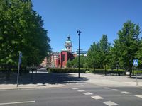
Some church in the distance
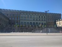
The royal palace
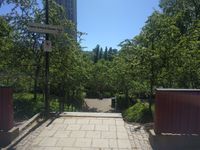
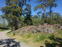
A cozy park
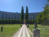
Another interesting park with a circular building around it
A bascule bridge, south of Södermalm
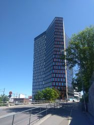
Quite interesting modern architecture
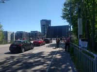
The park in Kärrtorp
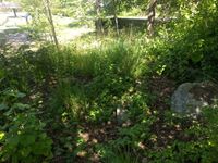
The hashpoint is there
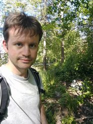
Me at the hashpoint
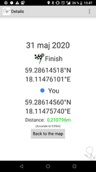
Proof
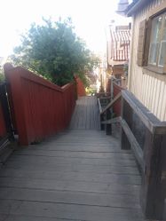
Some hidden wooden stairs in Södermalm
Another church
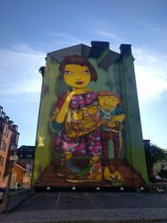
A huge wall painting


