Difference between revisions of "2020-09-19 50 8"
From Geohashing
([live picture]... especially if it is that steep) |
(info) |
||
| (3 intermediate revisions by 2 users not shown) | |||
| Line 14: | Line 14: | ||
__NOTOC__ | __NOTOC__ | ||
== Location == | == Location == | ||
| − | + | This Geohash is located in the mountains near Hattenheim. | |
== Participants == | == Participants == | ||
| − | + | * [[User:Lyrla|Lyrla]] | |
| − | + | * A yet unnamed dragalong | |
== Plans == | == Plans == | ||
| Line 24: | Line 24: | ||
== Expedition == | == Expedition == | ||
| − | + | It seems that they reached the coordinates. | |
== Tracklog == | == Tracklog == | ||
| Line 56: | Line 56: | ||
== Achievements == | == Achievements == | ||
{{#vardefine:ribbonwidth|800px}} | {{#vardefine:ribbonwidth|800px}} | ||
| − | |||
| − | |||
| − | |||
| − | |||
| − | |||
| − | |||
| − | |||
| − | |||
| − | |||
| − | |||
| − | |||
| − | |||
| − | |||
| − | |||
| − | |||
| − | |||
[[Category:Expeditions]] | [[Category:Expeditions]] | ||
| − | |||
[[Category:Expeditions with photos]] | [[Category:Expeditions with photos]] | ||
| − | |||
| − | |||
| − | |||
| − | |||
| − | |||
[[Category:Coordinates reached]] | [[Category:Coordinates reached]] | ||
| − | + | {{location|DE|HE|SWA}} | |
| − | |||
| − | |||
| − | |||
| − | |||
| − | |||
| − | |||
| − | |||
| − | |||
| − | |||
| − | |||
| − | |||
| − | |||
| − | |||
| − | |||
| − | |||
| − | |||
| − | |||
Latest revision as of 20:49, 26 September 2020
| Sat 19 Sep 2020 in 50,8: 50.0678354, 8.0314367 geohashing.info google osm bing/os kml crox |
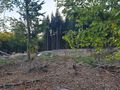
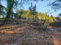
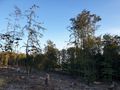
Location
This Geohash is located in the mountains near Hattenheim.
Participants
- Lyrla
- A yet unnamed dragalong
Plans
Expedition
It seems that they reached the coordinates.
Tracklog
Photos

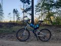
At the Hash
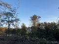
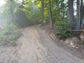
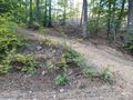
Forest at the hash
Forest at the hash
Forest at the hash
Forest at the hash
How I got there
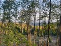
You can see Kloster (=monastery) Eberbach halfway down and the Rhine valley and the Rhine (where I came from) far down
What a lovely little road to ride your bike up...
... especially if it is that steep


