Difference between revisions of "2020-10-14 47 -122"
From Geohashing
([live picture]Lake [https://openstreetmap.org/?lat=47.70979950&lon=-122.17564700&zoom=16&layers=B000FTF @47.7098,-122.1756]) |
([live picture]Spud [https://openstreetmap.org/?lat=47.70536560&lon=-122.21291280&zoom=16&layers=B000FTF @47.7054,-122.2129]) |
||
| Line 34: | Line 34: | ||
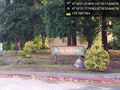
Image:2020-10-14_47_-122_thomcat_1602704739368.jpg|Lake [https://openstreetmap.org/?lat=47.70979950&lon=-122.17564700&zoom=16&layers=B000FTF @47.7098,-122.1756] | Image:2020-10-14_47_-122_thomcat_1602704739368.jpg|Lake [https://openstreetmap.org/?lat=47.70979950&lon=-122.17564700&zoom=16&layers=B000FTF @47.7098,-122.1756] | ||
| + | |||
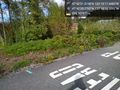
| + | Image:2020-10-14_47_-122_thomcat_1602705362780.jpg|Spud [https://openstreetmap.org/?lat=47.70536560&lon=-122.21291280&zoom=16&layers=B000FTF @47.7054,-122.2129] | ||
</gallery> | </gallery> | ||
Revision as of 19:56, 14 October 2020
| Wed 14 Oct 2020 in Seattle: 47.7059777, -122.1715134 geohashing.info google osm bing/os kml crox |
Location
A residential street in the Firloch neighborhood, near Totem Lake.
Participants
Plans
Lunchtime visit, toll bridge at least one way.
Expedition
Tracklog
Photos
Totem Firs @47.7060,-122.1732

Geohasher @47.7060,-122.1715
Lake @47.7098,-122.1756
Spud @47.7054,-122.2129


