Difference between revisions of "2020-10-28 47 -122"
From Geohashing
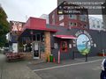
([live picture]Geohasher [https://openstreetmap.org/?lat=47.65101130&lon=-122.38761080&zoom=16&layers=B000FTF @47.6510,-122.3876]) |
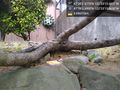
([live picture]Fries [https://openstreetmap.org/?lat=47.65102750&lon=-122.38762860&zoom=16&layers=B000FTF @47.6510,-122.3876]) |
||
| Line 32: | Line 32: | ||
Image:2020-10-28_47_-122_thomcat_1603920869323.jpg|Geohasher [https://openstreetmap.org/?lat=47.65101130&lon=-122.38761080&zoom=16&layers=B000FTF @47.6510,-122.3876] | Image:2020-10-28_47_-122_thomcat_1603920869323.jpg|Geohasher [https://openstreetmap.org/?lat=47.65101130&lon=-122.38761080&zoom=16&layers=B000FTF @47.6510,-122.3876] | ||
| + | |||
| + | Image:2020-10-28_47_-122_thomcat_1603920935738.jpg|Fries [https://openstreetmap.org/?lat=47.65102750&lon=-122.38762860&zoom=16&layers=B000FTF @47.6510,-122.3876] | ||
</gallery> | </gallery> | ||
Revision as of 21:35, 28 October 2020
| Wed 28 Oct 2020 in Seattle: 47.6510216, -122.3876253 geohashing.info google osm bing/os kml crox |
Location
A hillside sidewalk on 24th Avenue (northbound) on Magnolia hill.
Participants
Plans
Mid-day visit, snacking on some fries.
Expedition
Tracklog
Photos
Waiting for fries @47.6483,-122.3784

Geohasher @47.6510,-122.3876
Fries @47.6510,-122.3876


