2020-12-13 52 9
| Sun 13 Dec 2020 in 52,9: 52.3731049, 9.4947041 geohashing.info google osm bing/os kml crox |
Location
In the fields near Ostermunzel
Participants
Plans
Go there by bike, meet at the hashpoint at 15:00, visit the boulder of Ostermunzel.
Expedition
DLichti
I left early to have some time for OSM mapping along the way. The weather was cloudy, slightly raining, but not too cold. In Lohnde, I left the canal to head south through the fields. The location turned out to be right by the side of a field. I reached it at around 14:30 and took some pictures.
Since the meeting was arranged at 15:00, made a little detour to explore the surroundings. There were also some details to add to OpenStreetMap. When I came back, another cyclist was waiting at the hashpoint. It was Fippe.
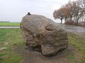
We waited until 15:00, but noone else turned up. Then, we went on to see the Colossus of Ostermunzel which is located on the nearby Mühlenberg. With its mighty height of 68m, it even has a summit registry, where we left a short message. Then, it was time to head home again, and we parted, hoping to meet again at some future hashpoint.
Tracklog
Photos
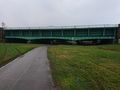
Canal bridge in Seelze
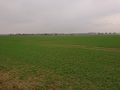
Ostermunzel near the hashpoint

DLichti's proof
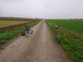
Our trusty bikes
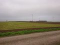
Mühlenberg near the hashpoint
The hat was there.


Achievements
DLichti earned the OpenStreetMap achievement
|