| Sat 9 Jan 2021 in 52,5: 52.1082552, 5.2832894 geohashing.info google osm bing/os kml crox |
Location
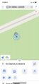
In National Park "De Utrechtse Heuvelrug", near Soesterberg. According to the map, the hash was close to an intersection of a footpath and a bridle path.
Participants
Plans
Cycle along the Verlengde Slotlaan, then continue on foot into the forest to get as close as possible.
Expedition
Photos
GPS proof
