Difference between revisions of "2021-02-09 45 4"
(→Expedition) |
(→Photos: Add photos) |
||
| Line 16: | Line 16: | ||
== Photos == | == Photos == | ||
| + | <gallery> | ||
| + | Image:2021-02-09 45 4 01.jpg | It's behind that hill | ||
| + | Image:2021-02-09 45 4 02.jpg | Lozanne in the distance | ||
| + | Image:2021-02-09 45 4 03.jpg | Entering Morancé | ||
| + | Image:2021-02-09 45 4 04.jpg | Near the geohash | ||
| + | Image:2021-02-09 45 4 05.jpg | At the geohash | ||
| + | Image:2021-02-09 45 4 06.png | Coordinates reached | ||
| + | Image:2021-02-09 45 4 07.jpg | Stupid grin | ||
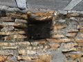
| + | Image:2021-02-09 45 4 08.jpg | An old abandoned house | ||
| + | Image:2021-02-09 45 4 09.jpg | Discovering a geocache | ||
| + | </gallery> | ||
== Achievements == | == Achievements == | ||
| Line 28: | Line 39: | ||
__NOTOC__ | __NOTOC__ | ||
[[Category:Expeditions]] | [[Category:Expeditions]] | ||
| + | [[Category:Expeditions with photos]] | ||
[[Category:Coordinates reached]] | [[Category:Coordinates reached]] | ||
{{location|FR|69}} | {{location|FR|69}} | ||
Revision as of 22:14, 9 February 2021
| Tue 9 Feb 2021 in 45,4: 45.8971011, 4.6898974 geohashing.info google osm bing/os kml crox |
Location
In a hedge, at the foot of a hill in Morancé.
Participants
Expedition
I took the bus from Lyon to Lozanne, crossed the Azergues river and started hiking through the foothills of the Beaujolais region. A footpath led me to Saint-Pierre, a hamlet near Morancé, and to the geohash. The coordinates were located in a hedge, at the foot of a small hill. I reached them at 14:41.
After recording proof a taking a small detour to discover a nearby geocache, I resumed my walk along the footpath. After a few kilometers, I left the trail and the hills, crossed a golf course, and rejoined the river. I arrived at Anse just in time to catch the 16:40 train to Lyon.
Photos
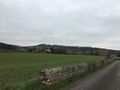
It's behind that hill
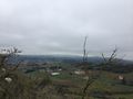
Lozanne in the distance
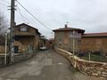
Entering Morancé
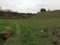
Near the geohash
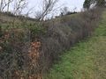
At the geohash
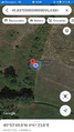
Coordinates reached
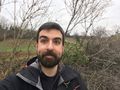
Stupid grin
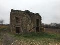
An old abandoned house
Discovering a geocache


Achievements
Baarde earned the Land geohash achievement
|